
Presentation Summary
Explore the science behind tornado warnings, the technology used for detection, and their cultural impact, including global safety protocols and the human element in life-saving responses.
Full Presentation Transcript
Slide 1: Tornado Warnings: From Meteorological Science to Cultural Impact
Comprehensive Exploration of Tornado Warning Systems, Detection Methods, Alert Mechanisms, and Global Safety Protocols
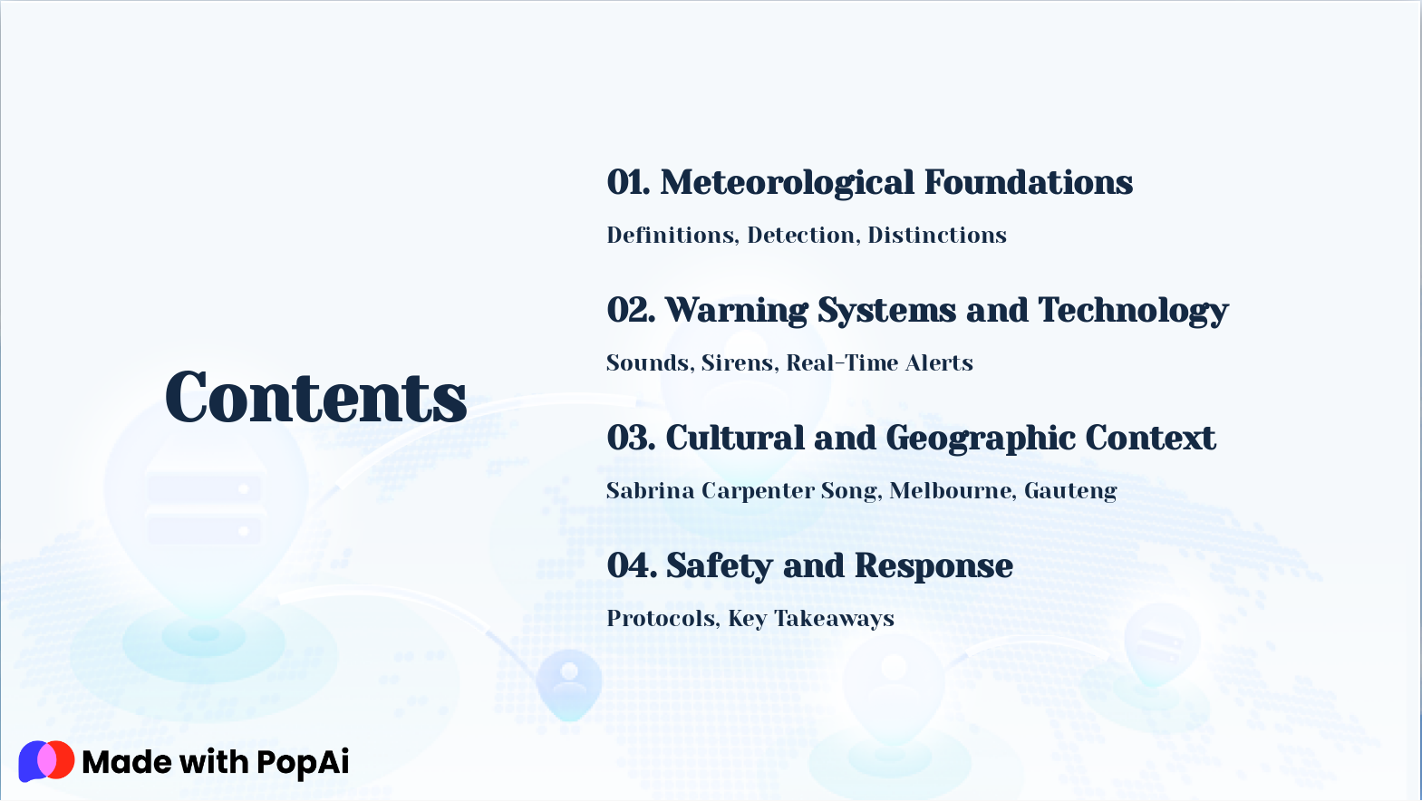
Slide 2: Contents
- Meteorological Foundations: Definitions, Detection, Distinctions
- Warning Systems and Technology: Sounds, Sirens, Real-Time Alerts
- Cultural and Geographic Context: Sabrina Carpenter Song, Melbourne, Gauteng
- Safety and Response: Protocols, Key Takeaways
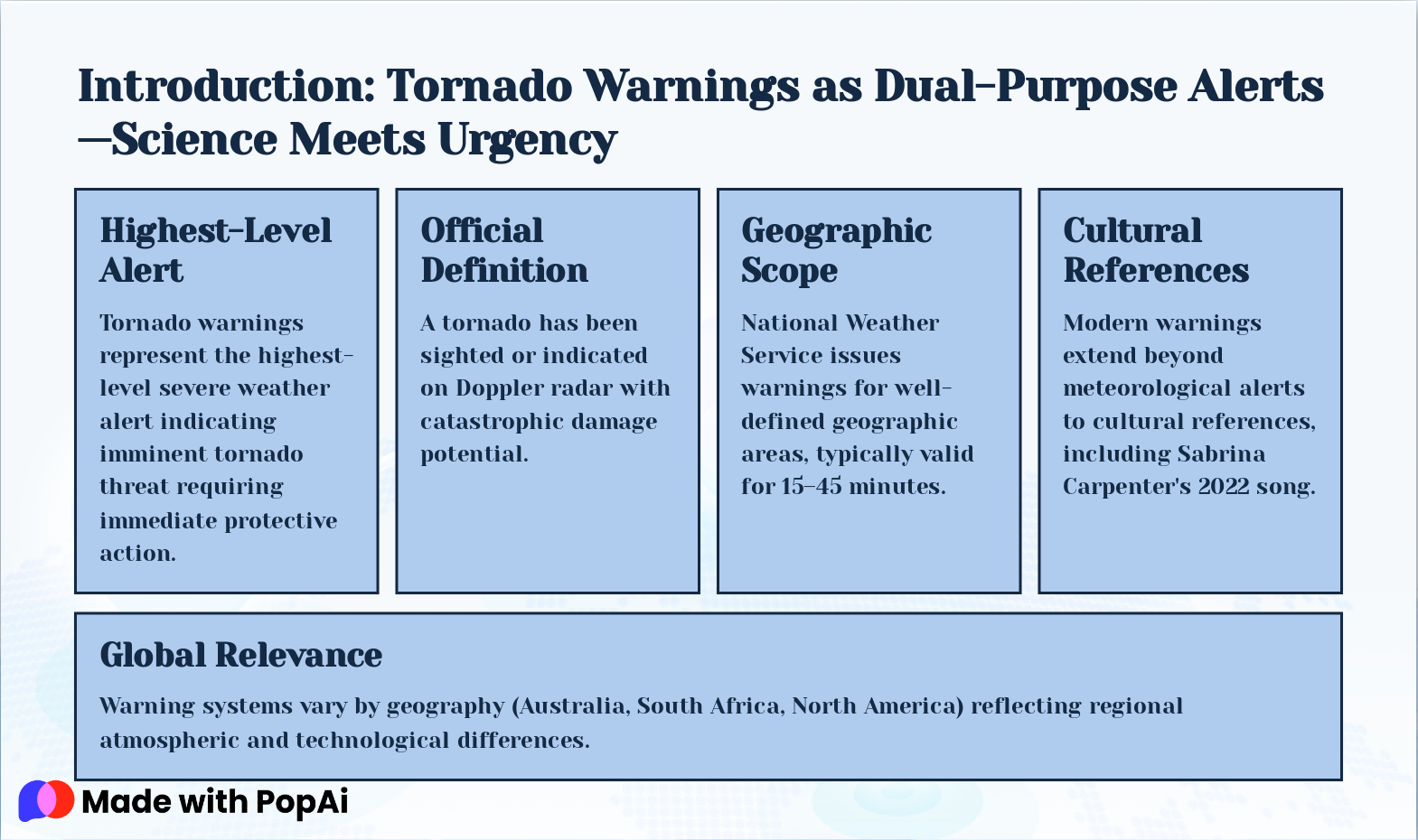
Slide 3: Introduction: Tornado Warnings as Dual-Purpose Alerts—Science Meets Urgency
- Highest-Level Alert: Tornado warnings represent the highest-level severe weather alert indicating imminent tornado threat requiring immediate protective action.
- Official Definition: A tornado has been sighted or indicated on Doppler radar with catastrophic damage potential.
- Geographic Scope: National Weather Service issues warnings for well-defined geographic areas, typically valid for 15–45 minutes.
- Cultural References: Modern warnings extend beyond meteorological alerts to cultural references, including Sabrina Carpenter's 2022 song.
- Global Relevance: Warning systems vary by geography (Australia, South Africa, North America) reflecting regional atmospheric and technological differences.
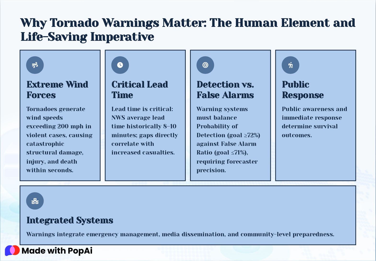
Slide 4: Why Tornado Warnings Matter: The Human Element and Life-Saving Imperative
- Extreme Wind Forces: Tornadoes generate wind speeds exceeding 200 mph in violent cases, causing catastrophic structural damage, injury, and death within seconds.
- Critical Lead Time: Lead time is critical: NWS average lead time historically 8–10 minutes; gaps directly correlate with increased casualties.
- Detection vs. False Alarms: Warning systems must balance Probability of Detection (goal ≥72%) against False Alarm Ratio (goal ≤71%), requiring forecaster precision.
- Public Response: Public awareness and immediate response determine survival outcomes.
- Integrated Systems: Warnings integrate emergency management, media dissemination, and community-level preparedness.
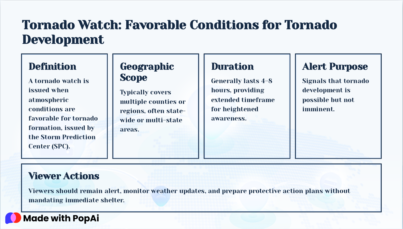
Slide 5: Tornado Watch: Favorable Conditions for Tornado Development
- Definition: A tornado watch is issued when atmospheric conditions are favorable for tornado formation, issued by the Storm Prediction Center (SPC).
- Geographic Scope: Typically covers multiple counties or regions, often state-wide or multi-state areas.
- Duration: Generally lasts 4–8 hours, providing extended timeframe for heightened awareness.
- Alert Purpose: Signals that tornado development is possible but not imminent.
- Viewer Actions: Viewers should remain alert, monitor weather updates, and prepare protective action plans without mandating immediate shelter.
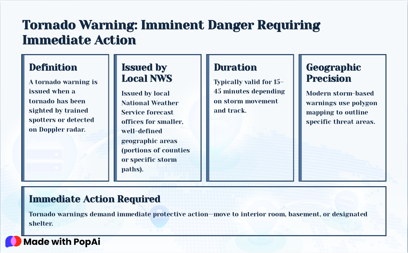
Slide 6: Tornado Warning: Imminent Danger Requiring Immediate Action
- Definition: A tornado warning is issued when a tornado has been sighted by trained spotters or detected on Doppler radar.
- Issued by Local NWS: Issued by local National Weather Service forecast offices for smaller, well-defined geographic areas (portions of counties or specific storm paths).
- Duration: Typically valid for 15–45 minutes depending on storm movement and track.
- Geographic Precision: Modern storm-based warnings use polygon mapping to outline specific threat areas.
- Immediate Action Required: Tornado warnings demand immediate protective action—move to interior room, basement, or designated shelter.
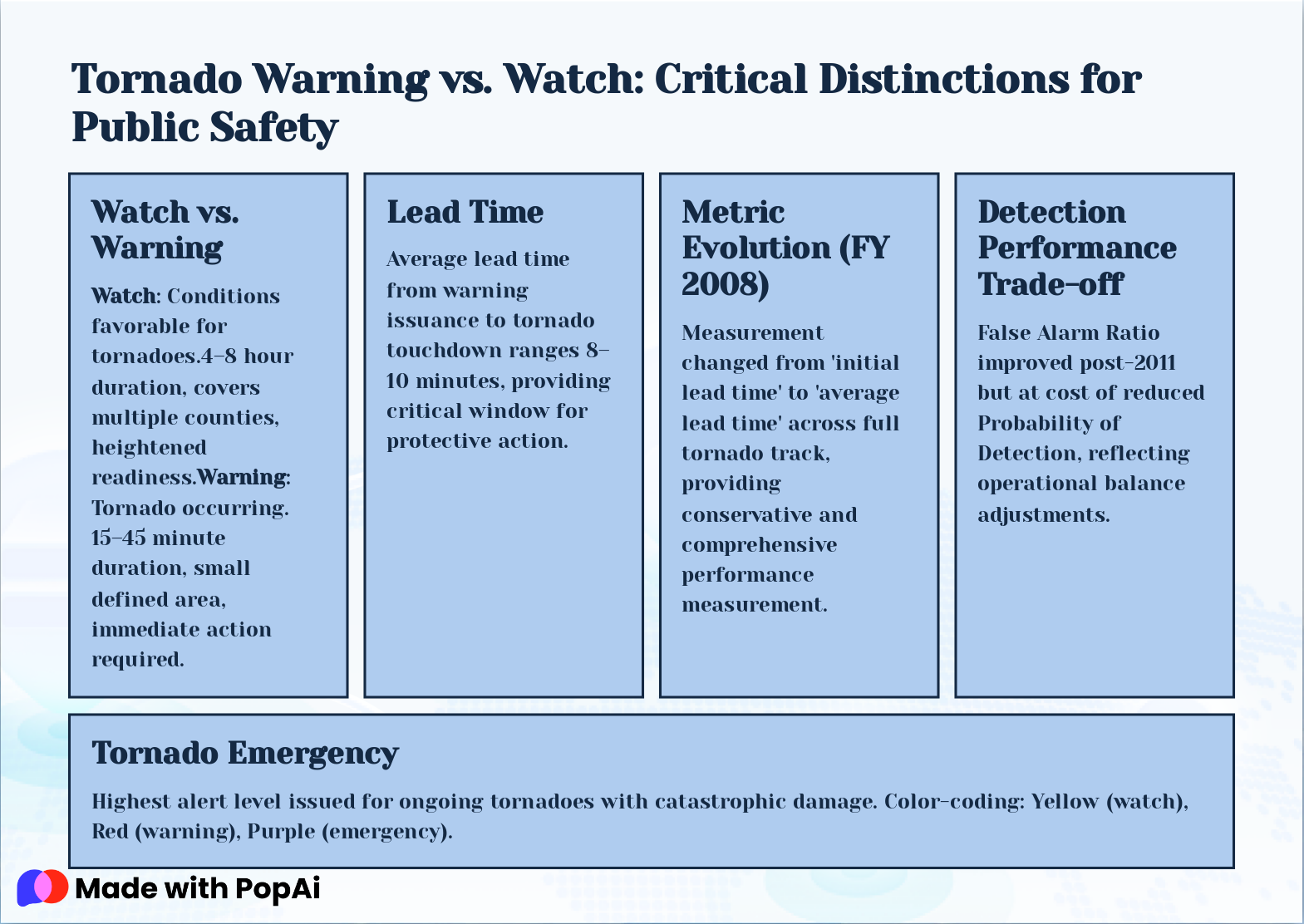
Slide 7: Tornado Warning vs. Watch: Critical Distinctions for Public Safety
- Watch vs. Warning: Watch : Conditions favorable for tornadoes.4–8 hour duration, covers multiple counties, heightened readiness. Warning : Tornado occurring. 15–45 minute duration, small defined area, immediate action required.
- Lead Time: Average lead time from warning issuance to tornado touchdown ranges 8–10 minutes, providing critical window for protective action.
- Metric Evolution (FY 2008): Measurement changed from 'initial lead time' to 'average lead time' across full tornado track, providing conservative and comprehensive performance measurement.
- Detection Performance Trade-off: False Alarm Ratio improved post-2011 but at cost of reduced Probability of Detection, reflecting operational balance adjustments.
- Tornado Emergency: Highest alert level issued for ongoing tornadoes with catastrophic damage. Color-coding: Yellow (watch), Red (warning), Purple (emergency).
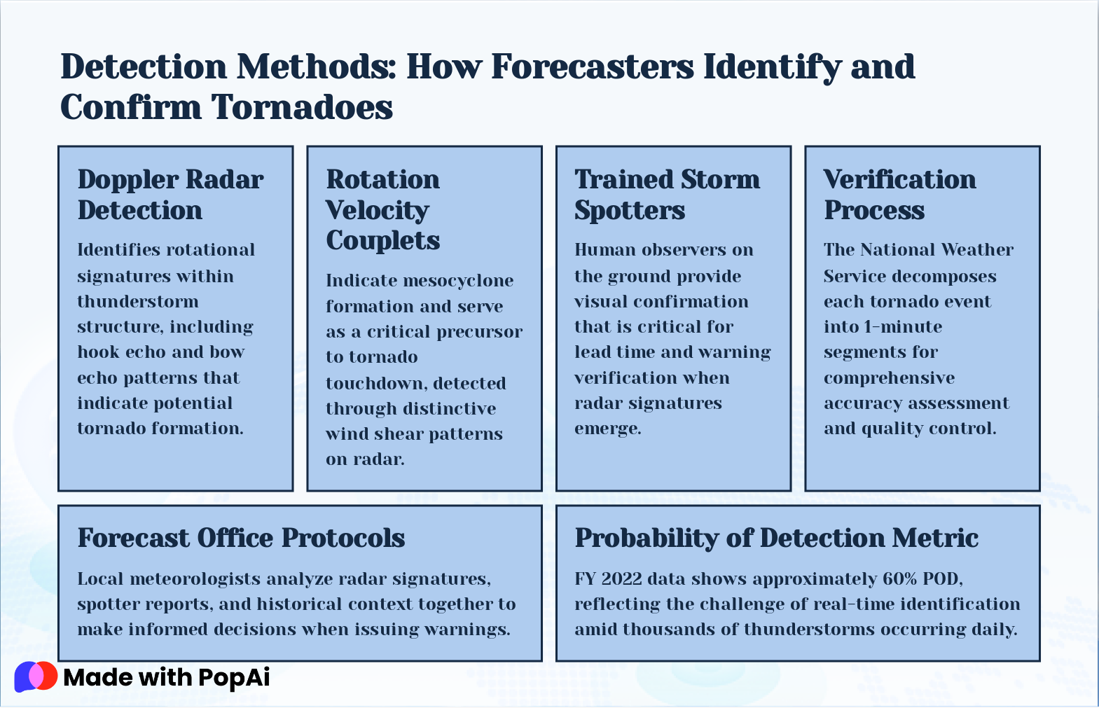
Slide 8: Detection Methods: How Forecasters Identify and Confirm Tornadoes
- Doppler Radar Detection: Identifies rotational signatures within thunderstorm structure, including hook echo and bow echo patterns that indicate potential tornado formation.
- Rotation Velocity Couplets: Indicate mesocyclone formation and serve as a critical precursor to tornado touchdown, detected through distinctive wind shear patterns on radar.
- Trained Storm Spotters: Human observers on the ground provide visual confirmation that is critical for lead time and warning verification when radar signatures emerge.
- Verification Process: The National Weather Service decomposes each tornado event into 1-minute segments for comprehensive accuracy assessment and quality control.
- Forecast Office Protocols: Local meteorologists analyze radar signatures, spotter reports, and historical context together to make informed decisions when issuing warnings.
- Probability of Detection Metric: FY 2022 data shows approximately 60% POD, reflecting the challenge of real-time identification amid thousands of thunderstorms occurring daily.
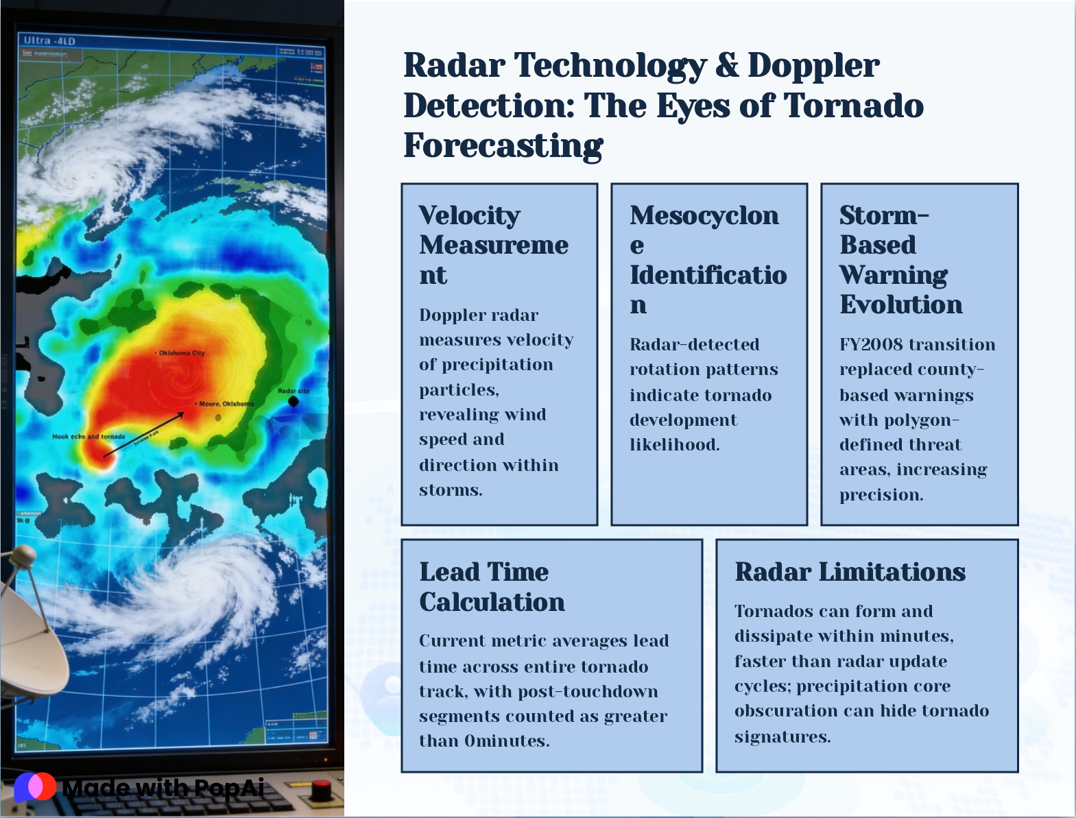
Slide 9: Radar Technology & Doppler Detection: The Eyes of Tornado Forecasting
- Velocity Measurement: Doppler radar measures velocity of precipitation particles, revealing wind speed and direction within storms.
- Mesocyclone Identification: Radar-detected rotation patterns indicate tornado development likelihood.
- Storm-Based Warning Evolution: FY2008 transition replaced county-based warnings with polygon-defined threat areas, increasing precision.
- Lead Time Calculation: Current metric averages lead time across entire tornado track, with post-touchdown segments counted as greater than 0minutes.
- Radar Limitations: Tornados can form and dissipate within minutes, faster than radar update cycles; precipitation core obscuration can hide tornado signatures.
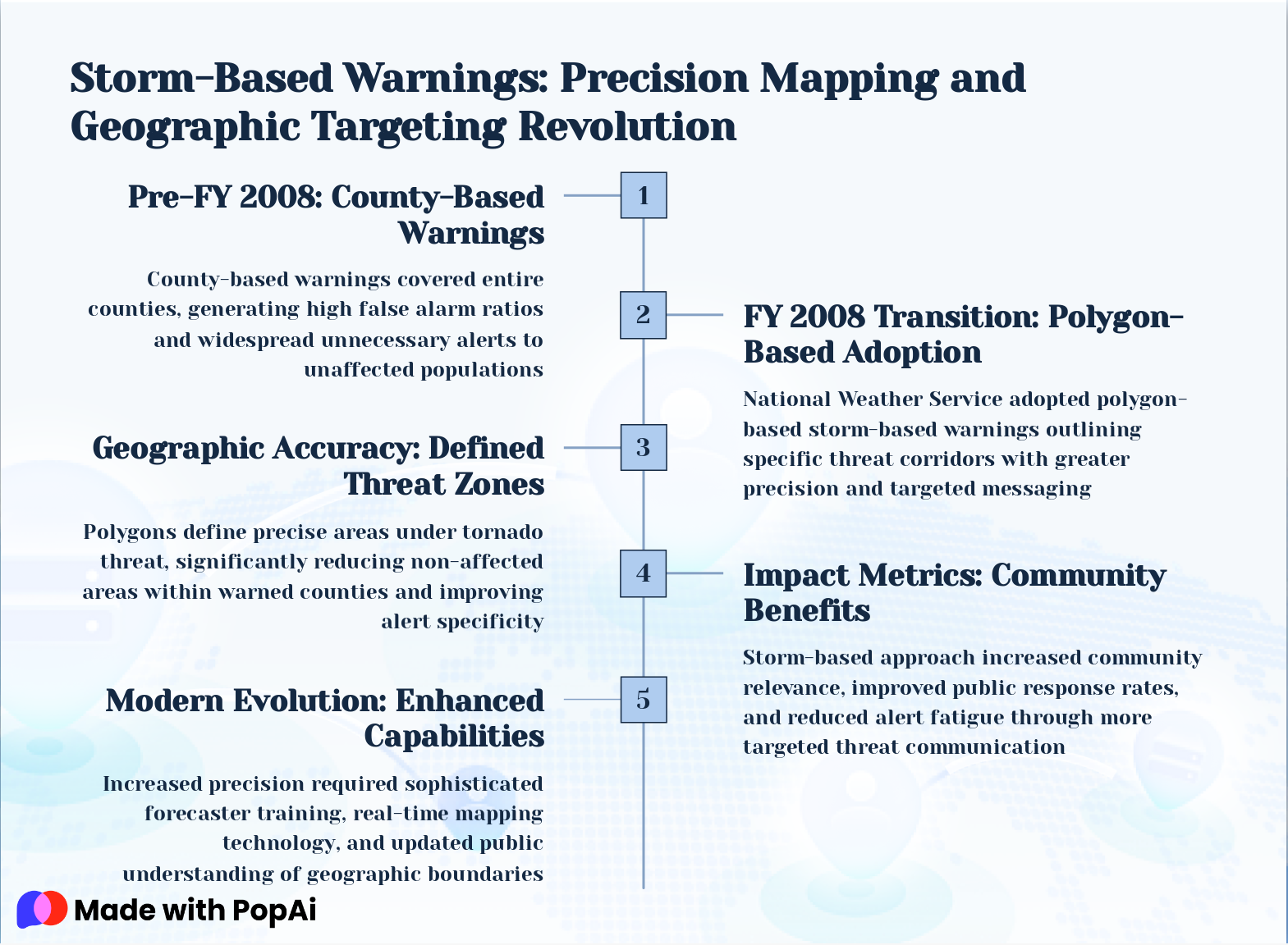
Slide 10: Storm-Based Warnings: Precision Mapping and Geographic Targeting Revolution
- Pre-FY 2008: County-Based Warnings: County-based warnings covered entire counties, generating high false alarm ratios and widespread unnecessary alerts to unaffected populations
- FY 2008 Transition: Polygon-Based Adoption: National Weather Service adopted polygon-based storm-based warnings outlining specific threat corridors with greater precision and targeted messaging
- Geographic Accuracy: Defined Threat Zones: Polygons define precise areas under tornado threat, significantly reducing non-affected areas within warned counties and improving alert specificity
- Impact Metrics: Community Benefits: Storm-based approach increased community relevance, improved public response rates, and reduced alert fatigue through more targeted threat communication
- Modern Evolution: Enhanced Capabilities: Increased precision required sophisticated forecaster training, real-time mapping technology, and updated public understanding of geographic boundaries
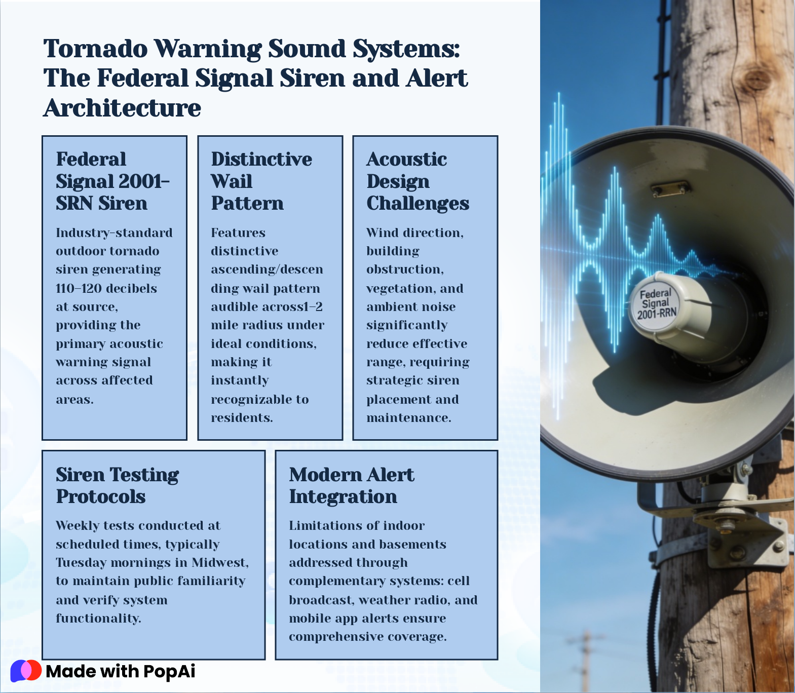
Slide 11: Tornado Warning Sound Systems: The Federal Signal Siren and Alert Architecture
- Federal Signal 2001-SRN Siren: Industry-standard outdoor tornado siren generating 110–120 decibels at source, providing the primary acoustic warning signal across affected areas.
- Distinctive Wail Pattern: Features distinctive ascending/descending wail pattern audible across1–2 mile radius under ideal conditions, making it instantly recognizable to residents.
- Acoustic Design Challenges: Wind direction, building obstruction, vegetation, and ambient noise significantly reduce effective range, requiring strategic siren placement and maintenance.
- Siren Testing Protocols: Weekly tests conducted at scheduled times, typically Tuesday mornings in Midwest, to maintain public familiarity and verify system functionality.
- Modern Alert Integration: Limitations of indoor locations and basements addressed through complementary systems: cell broadcast, weather radio, and mobile app alerts ensure comprehensive coverage.
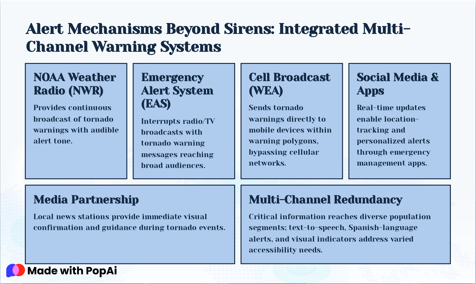
Slide 12: Alert Mechanisms Beyond Sirens: Integrated Multi-Channel Warning Systems
- NOAA Weather Radio (NWR): Provides continuous broadcast of tornado warnings with audible alert tone.
- Emergency Alert System (EAS): Interrupts radio/TV broadcasts with tornado warning messages reaching broad audiences.
- Cell Broadcast (WEA): Sends tornado warnings directly to mobile devices within warning polygons, bypassing cellular networks.
- Social Media & Apps: Real-time updates enable location-tracking and personalized alerts through emergency management apps.
- Media Partnership: Local news stations provide immediate visual confirmation and guidance during tornado events.
- Multi-Channel Redundancy: Critical information reaches diverse population segments; text-to-speech, Spanish-language alerts, and visual indicators address varied accessibility needs.
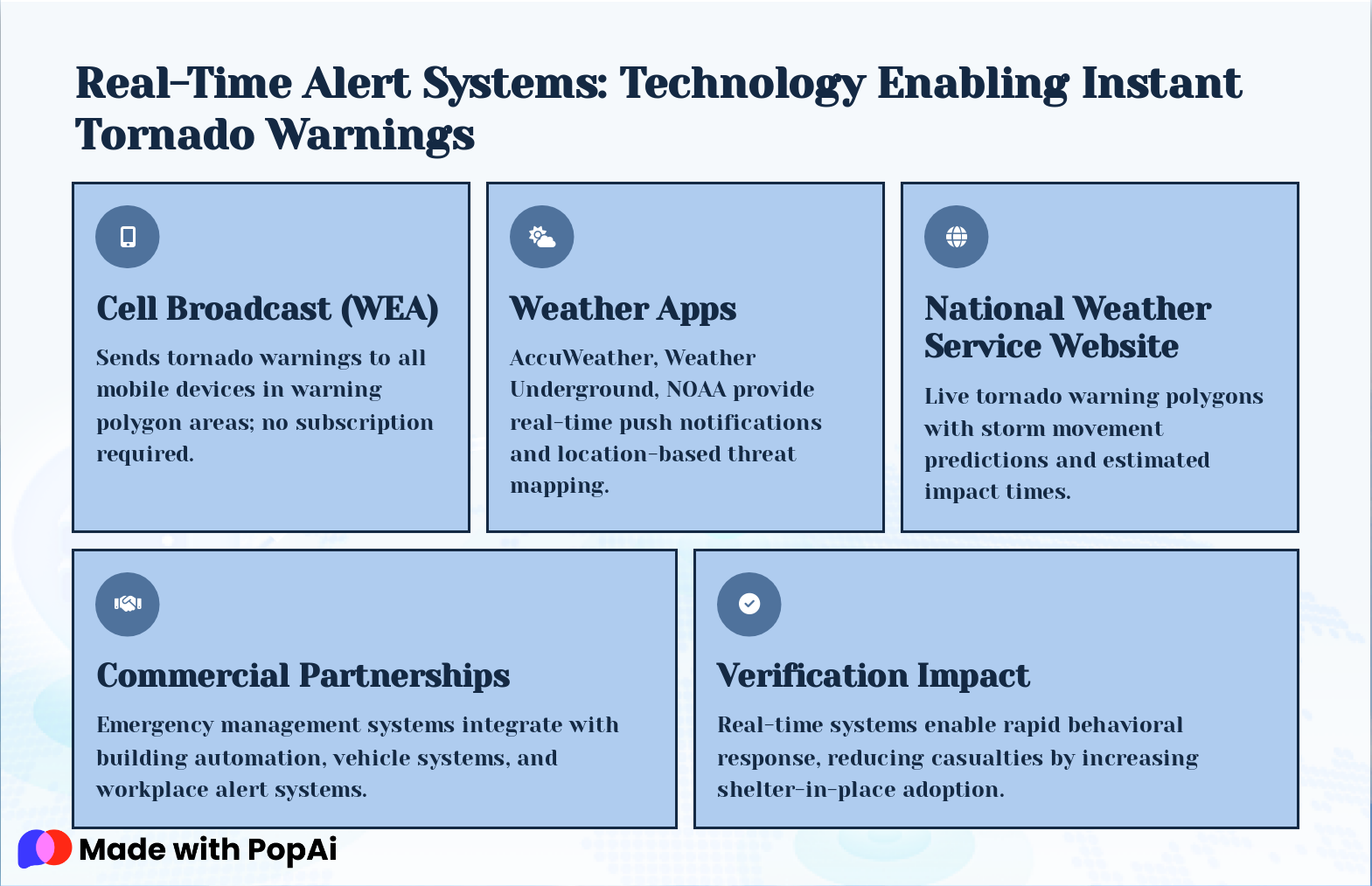
Slide 13: Real-Time Alert Systems: Technology Enabling Instant Tornado Warnings
- Cell Broadcast (WEA): Sends tornado warnings to all mobile devices in warning polygon areas; no subscription required.
- Weather Apps: AccuWeather, Weather Underground, NOAA provide real-time push notifications and location-based threat mapping.
- National Weather Service Website: Live tornado warning polygons with storm movement predictions and estimated impact times.
- Commercial Partnerships: Emergency management systems integrate with building automation, vehicle systems, and workplace alert systems.
- Verification Impact: Real-time systems enable rapid behavioral response, reducing casualties by increasing shelter-in-place adoption.
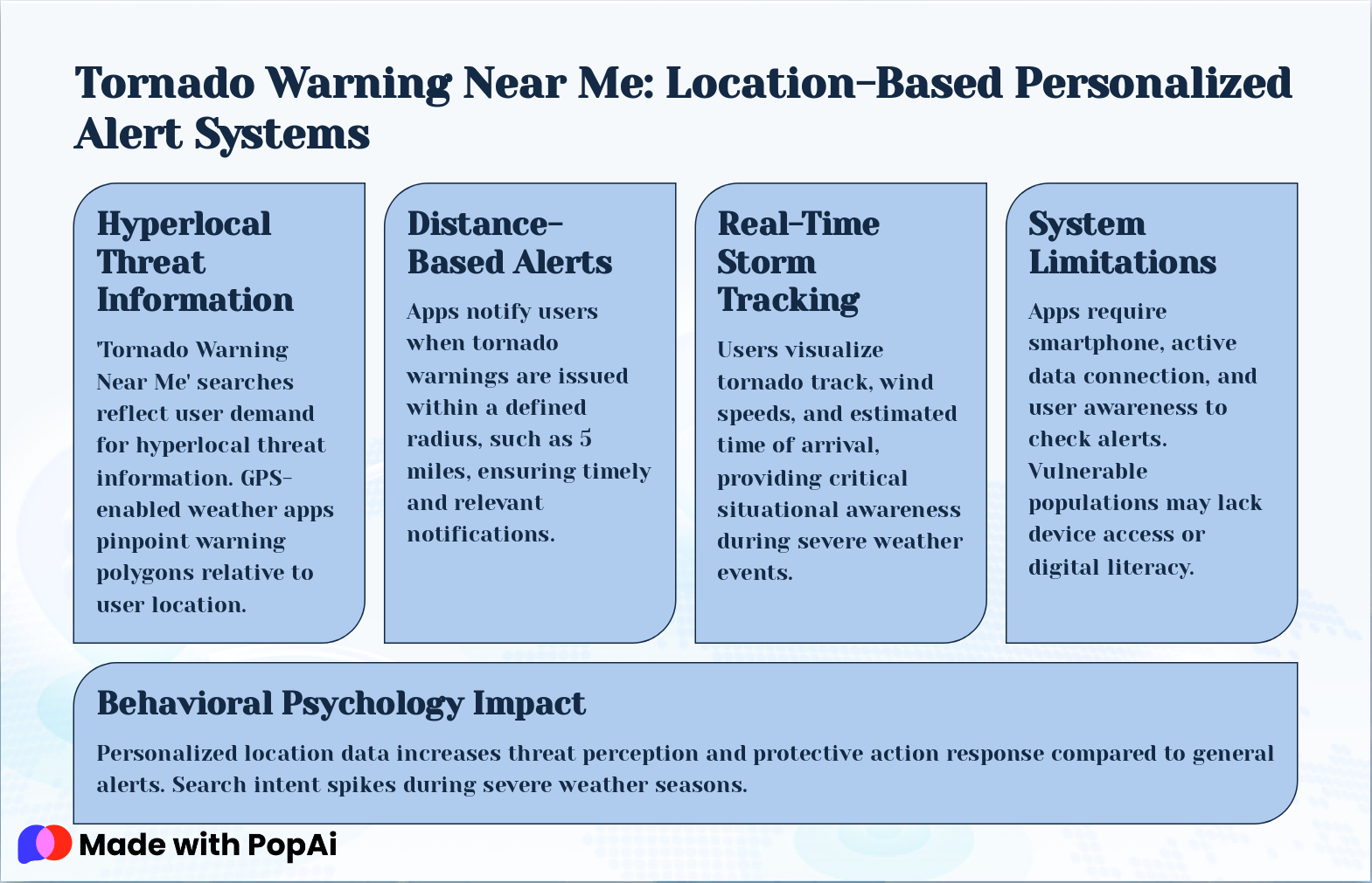
Slide 14: Tornado Warning Near Me: Location-Based Personalized Alert Systems
- Hyperlocal Threat Information: 'Tornado Warning Near Me' searches reflect user demand for hyperlocal threat information. GPS-enabled weather apps pinpoint warning polygons relative to user location.
- Distance-Based Alerts: Apps notify users when tornado warnings are issued within a defined radius, such as 5 miles, ensuring timely and relevant notifications.
- Real-Time Storm Tracking: Users visualize tornado track, wind speeds, and estimated time of arrival, providing critical situational awareness during severe weather events.
- System Limitations: Apps require smartphone, active data connection, and user awareness to check alerts. Vulnerable populations may lack device access or digital literacy.
- Behavioral Psychology Impact: Personalized location data increases threat perception and protective action response compared to general alerts. Search intent spikes during severe weather seasons.
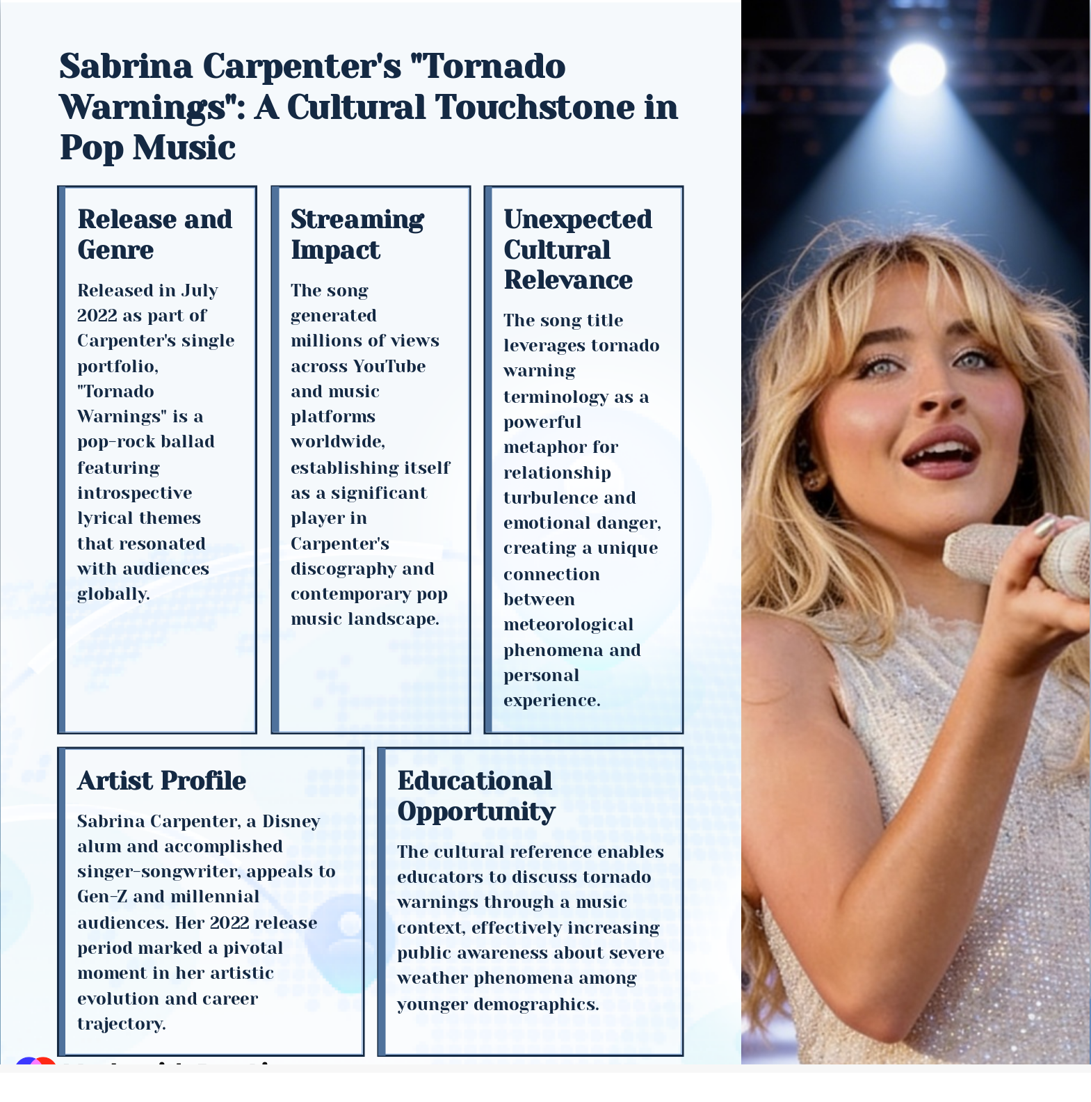
Slide 15: Sabrina Carpenter's "Tornado Warnings": A Cultural Touchstone in Pop Music
- Release and Genre: Released in July 2022 as part of Carpenter's single portfolio, "Tornado Warnings" is a pop-rock ballad featuring introspective lyrical themes that resonated with audiences globally.
- Streaming Impact: The song generated millions of views across YouTube and music platforms worldwide, establishing itself as a significant player in Carpenter's discography and contemporary pop music landscape.
- Unexpected Cultural Relevance: The song title leverages tornado warning terminology as a powerful metaphor for relationship turbulence and emotional danger, creating a unique connection between meteorological phenomena and personal experience.
- Artist Profile: Sabrina Carpenter, a Disney alum and accomplished singer-songwriter, appeals to Gen-Z and millennial audiences. Her 2022 release period marked a pivotal moment in her artistic evolution and career trajectory.
- Educational Opportunity: The cultural reference enables educators to discuss tornado warnings through a music context, effectively increasing public awareness about severe weather phenomena among younger demographics.
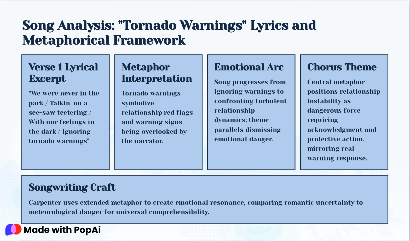
Slide 16: Song Analysis: "Tornado Warnings" Lyrics and Metaphorical Framework
- Verse 1 Lyrical Excerpt: "We were never in the park / Talkin' on a see-saw teetering / With our feelings in the dark / Ignoring tornado warnings"
- Metaphor Interpretation: Tornado warnings symbolize relationship red flags and warning signs being overlooked by the narrator.
- Emotional Arc: Song progresses from ignoring warnings to confronting turbulent relationship dynamics; theme parallels dismissing emotional danger.
- Chorus Theme: Central metaphor positions relationship instability as dangerous force requiring acknowledgment and protective action, mirroring real warning response.
- Songwriting Craft: Carpenter uses extended metaphor to create emotional resonance, comparing romantic uncertainty to meteorological danger for universal comprehensibility.
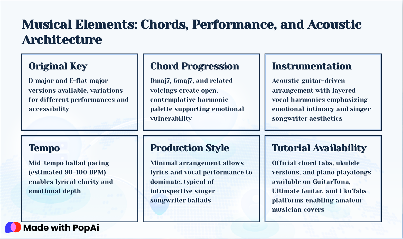
Slide 17: Musical Elements: Chords, Performance, and Acoustic Architecture
- Original Key: D major and E-flat major versions available, variations for different performances and accessibility
- Chord Progression: Dmaj7, Gmaj7, and related voicings create open, contemplative harmonic palette supporting emotional vulnerability
- Instrumentation: Acoustic guitar-driven arrangement with layered vocal harmonies emphasizing emotional intimacy and singer-songwriter aesthetics
- Tempo: Mid-tempo ballad pacing (estimated 90–100 BPM) enables lyrical clarity and emotional depth
- Production Style: Minimal arrangement allows lyrics and vocal performance to dominate, typical of introspective singer-songwriter ballads
- Tutorial Availability: Official chord tabs, ukulele versions, and piano playalongs available on GuitarTuna, Ultimate Guitar, and UkuTabs platforms enabling amateur musician covers
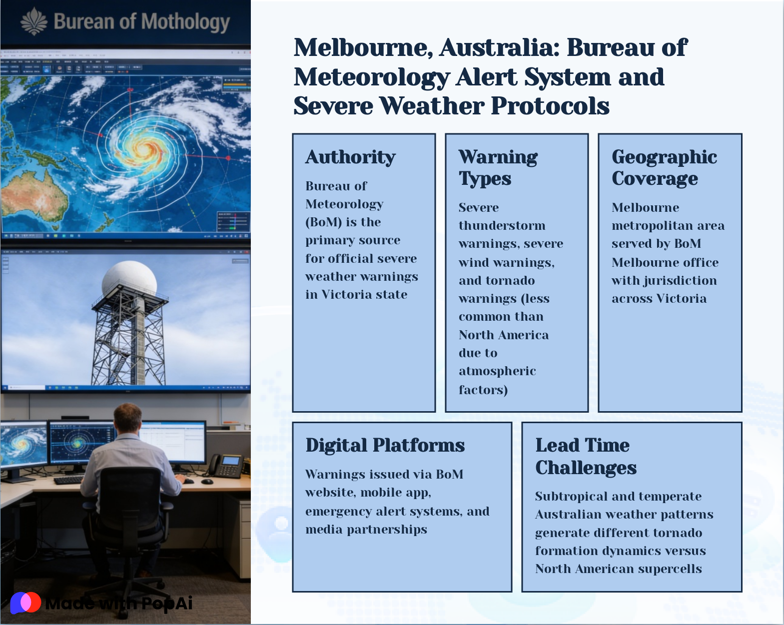
Slide 18: Melbourne, Australia: Bureau of Meteorology Alert System and Severe Weather Protocols
- Authority: Bureau of Meteorology (BoM) is the primary source for official severe weather warnings in Victoria state
- Warning Types: Severe thunderstorm warnings, severe wind warnings, and tornado warnings (less common than North America due to atmospheric factors)
- Geographic Coverage: Melbourne metropolitan area served by BoM Melbourne office with jurisdiction across Victoria
- Digital Platforms: Warnings issued via BoM website, mobile app, emergency alert systems, and media partnerships
- Lead Time Challenges: Subtropical and temperate Australian weather patterns generate different tornado formation dynamics versus North American supercells
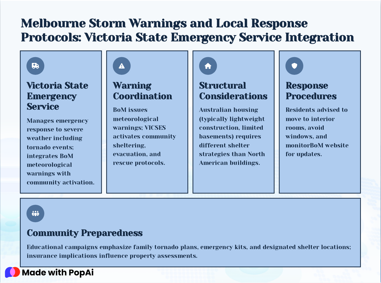
Slide 19: Melbourne Storm Warnings and Local Response Protocols: Victoria State Emergency Service Integration
- Victoria State Emergency Service: Manages emergency response to severe weather including tornado events; integrates BoM meteorological warnings with community activation.
- Warning Coordination: BoM issues meteorological warnings; VICSES activates community sheltering, evacuation, and rescue protocols.
- Structural Considerations: Australian housing (typically lightweight construction, limited basements) requires different shelter strategies than North American buildings.
- Response Procedures: Residents advised to move to interior rooms, avoid windows, and monitorBoM website for updates.
- Community Preparedness: Educational campaigns emphasize family tornado plans, emergency kits, and designated shelter locations; insurance implications influence property assessments.
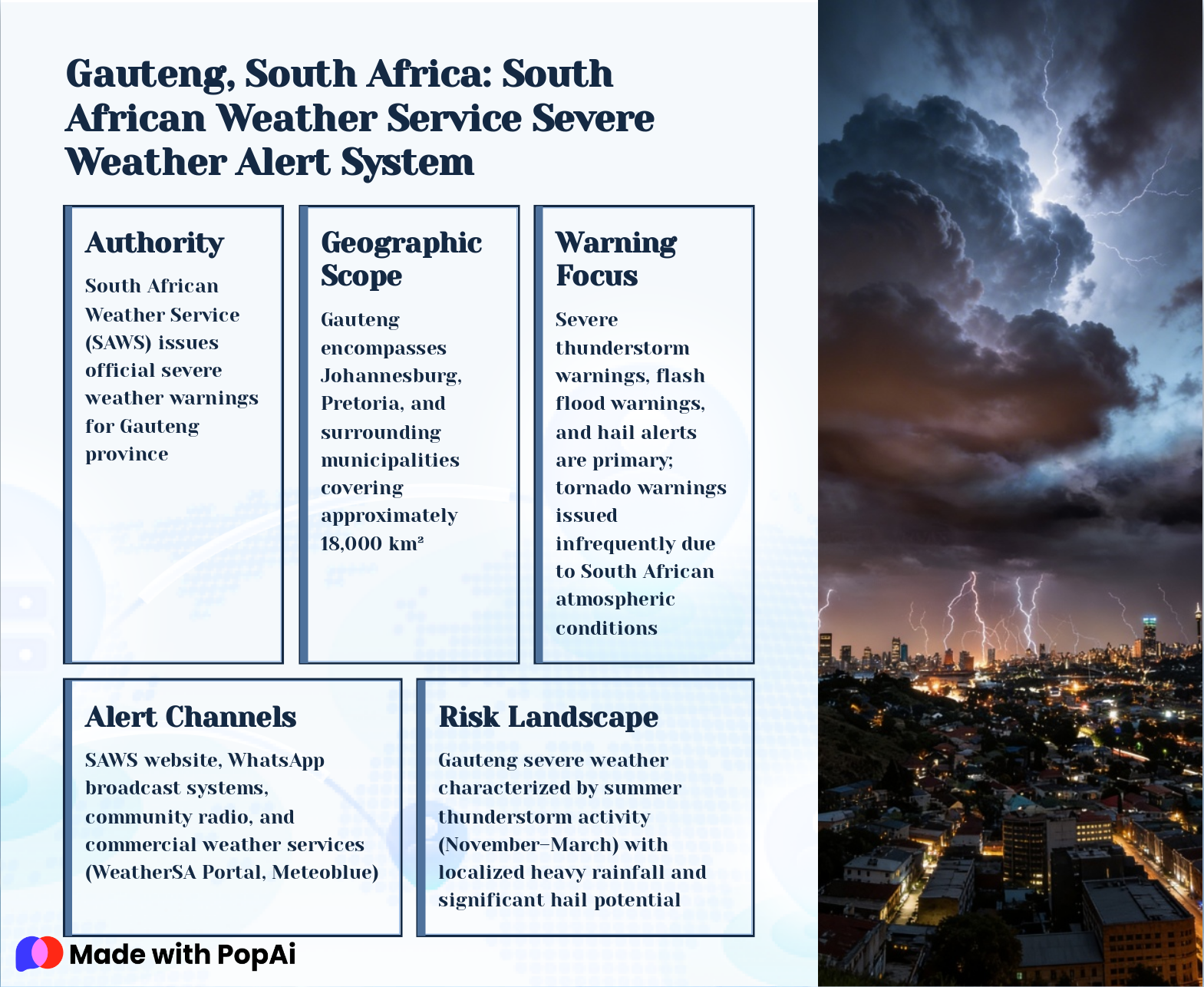
Slide 20: Gauteng, South Africa: South African Weather Service Severe Weather Alert System
- Authority: South African Weather Service (SAWS) issues official severe weather warnings for Gauteng province
- Geographic Scope: Gauteng encompasses Johannesburg, Pretoria, and surrounding municipalities covering approximately 18,000 km²
- Warning Focus: Severe thunderstorm warnings, flash flood warnings, and hail alerts are primary; tornado warnings issued infrequently due to South African atmospheric conditions
- Alert Channels: SAWS website, WhatsApp broadcast systems, community radio, and commercial weather services (WeatherSA Portal, Meteoblue)
- Risk Landscape: Gauteng severe weather characterized by summer thunderstorm activity (November–March) with localized heavy rainfall and significant hail potential
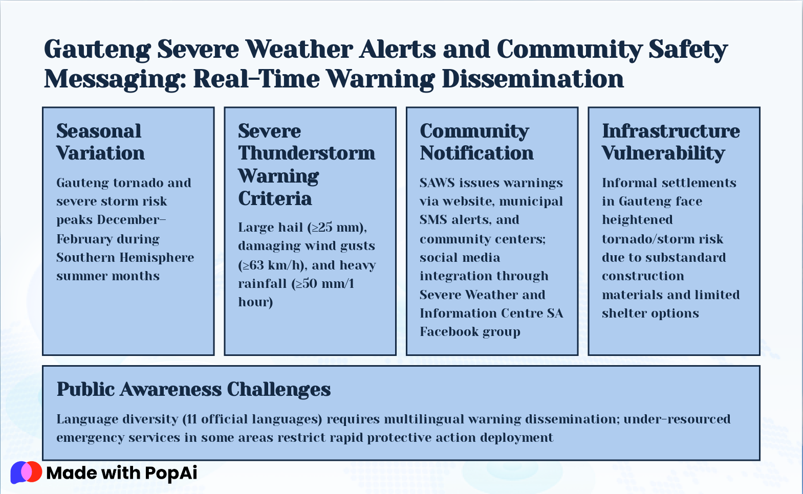
Slide 21: Gauteng Severe Weather Alerts and Community Safety Messaging: Real-Time Warning Dissemination
- Seasonal Variation: Gauteng tornado and severe storm risk peaks December–February during Southern Hemisphere summer months
- Severe Thunderstorm Warning Criteria: Large hail (≥25 mm), damaging wind gusts (≥63 km/h), and heavy rainfall (≥50 mm/1 hour)
- Community Notification: SAWS issues warnings via website, municipal SMS alerts, and community centers; social media integration through Severe Weather and Information Centre SA Facebook group
- Infrastructure Vulnerability: Informal settlements in Gauteng face heightened tornado/storm risk due to substandard construction materials and limited shelter options
- Public Awareness Challenges: Language diversity (11 official languages) requires multilingual warning dissemination; under-resourced emergency services in some areas restrict rapid protective action deployment
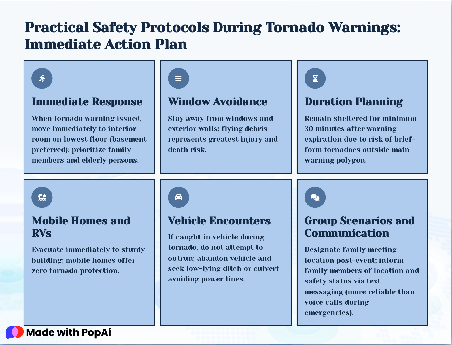
Slide 22: Practical Safety Protocols During Tornado Warnings: Immediate Action Plan
- Immediate Response: When tornado warning issued, move immediately to interior room on lowest floor (basement preferred); prioritize family members and elderly persons.
- Window Avoidance: Stay away from windows and exterior walls; flying debris represents greatest injury and death risk.
- Duration Planning: Remain sheltered for minimum 30 minutes after warning expiration due to risk of brief-form tornadoes outside main warning polygon.
- Mobile Homes and RVs: Evacuate immediately to sturdy building; mobile homes offer zero tornado protection.
- Vehicle Encounters: If caught in vehicle during tornado, do not attempt to outrun; abandon vehicle and seek low-lying ditch or culvert avoiding power lines.
- Group Scenarios and Communication: Designate family meeting location post-event; inform family members of location and safety status via text messaging (more reliable than voice calls during emergencies).
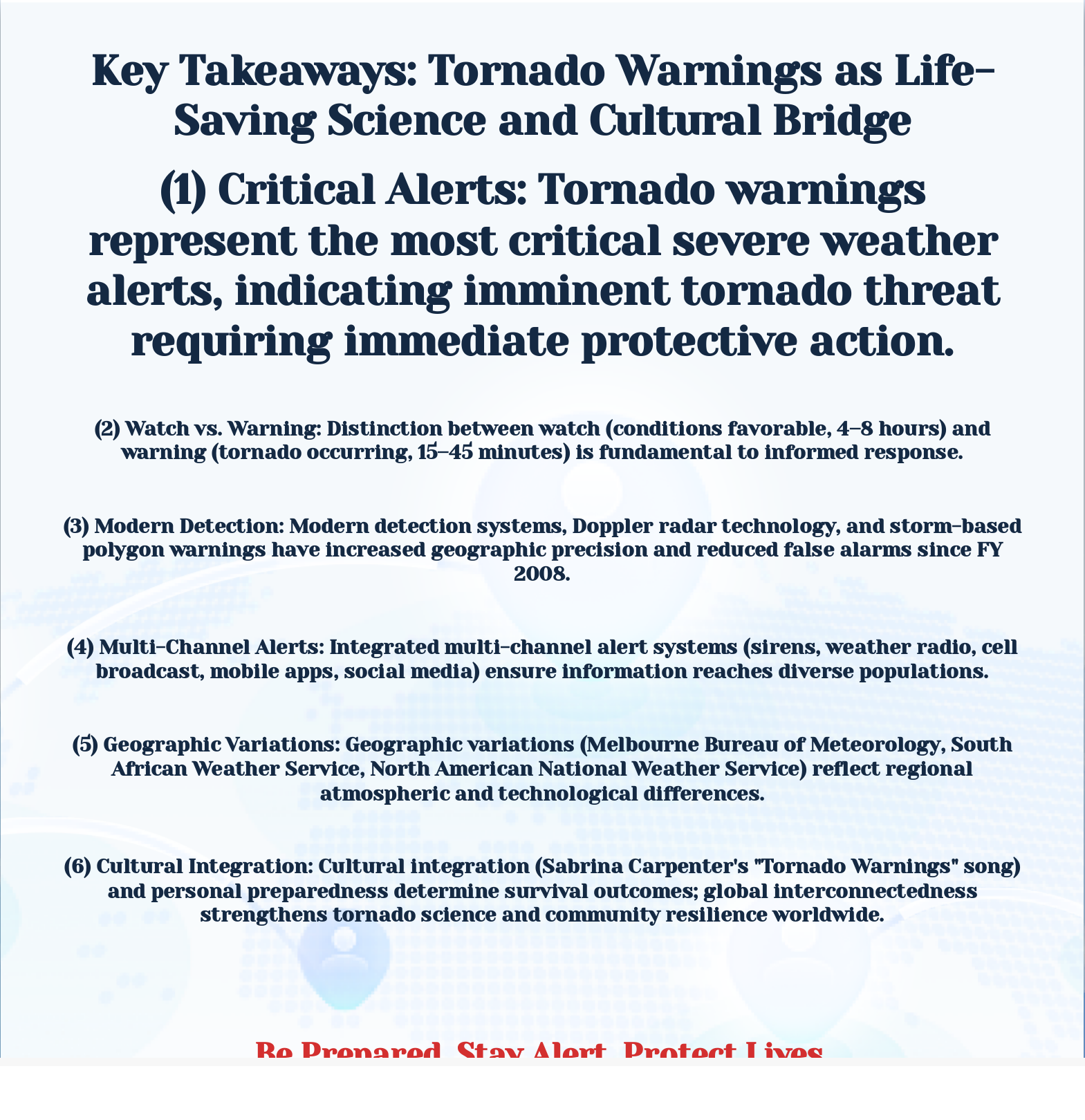
Slide 23: Key Takeaways: Tornado Warnings as Life-Saving Science and Cultural Bridge
Key Takeaways: Tornado Warnings as Life-Saving Science and Cultural Bridge (1) Critical Alerts: Tornado warnings represent the most critical severe weather alerts, indicating imminent tornado threat requiring immediate protective action. (2) Watch vs. Warning: Distinction between watch (conditions f...