

Presentation Summary
Dive into the Mediterranean climate of San Diego, California, exploring its geographic context, seasonal patterns, and unique weather phenomena.
Full Presentation Transcript
Slide 1: San Diego Weather: A Comprehensive Analysis of Southern California's Renowned Climate
Professional presentation exploring Mediterranean climate patterns, seasonal weather dynamics, and real-world implications for residents and visitors
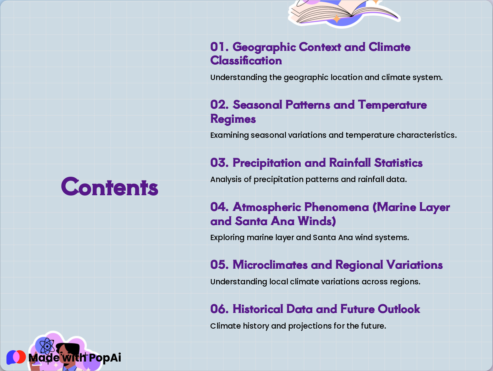
Slide 2: Contents
- Geographic Context and Climate Classification: Understanding the geographic location and climate system.
- Seasonal Patterns and Temperature Regimes: Examining seasonal variations and temperature characteristics.
- Precipitation and Rainfall Statistics: Analysis of precipitation patterns and rainfall data.
- Atmospheric Phenomena (Marine Layer and Santa Ana Winds): Exploring marine layer and Santa Ana wind systems.
- Microclimates and Regional Variations: Understanding local climate variations across regions.
- Historical Data and Future Outlook: Climate history and projections for the future.
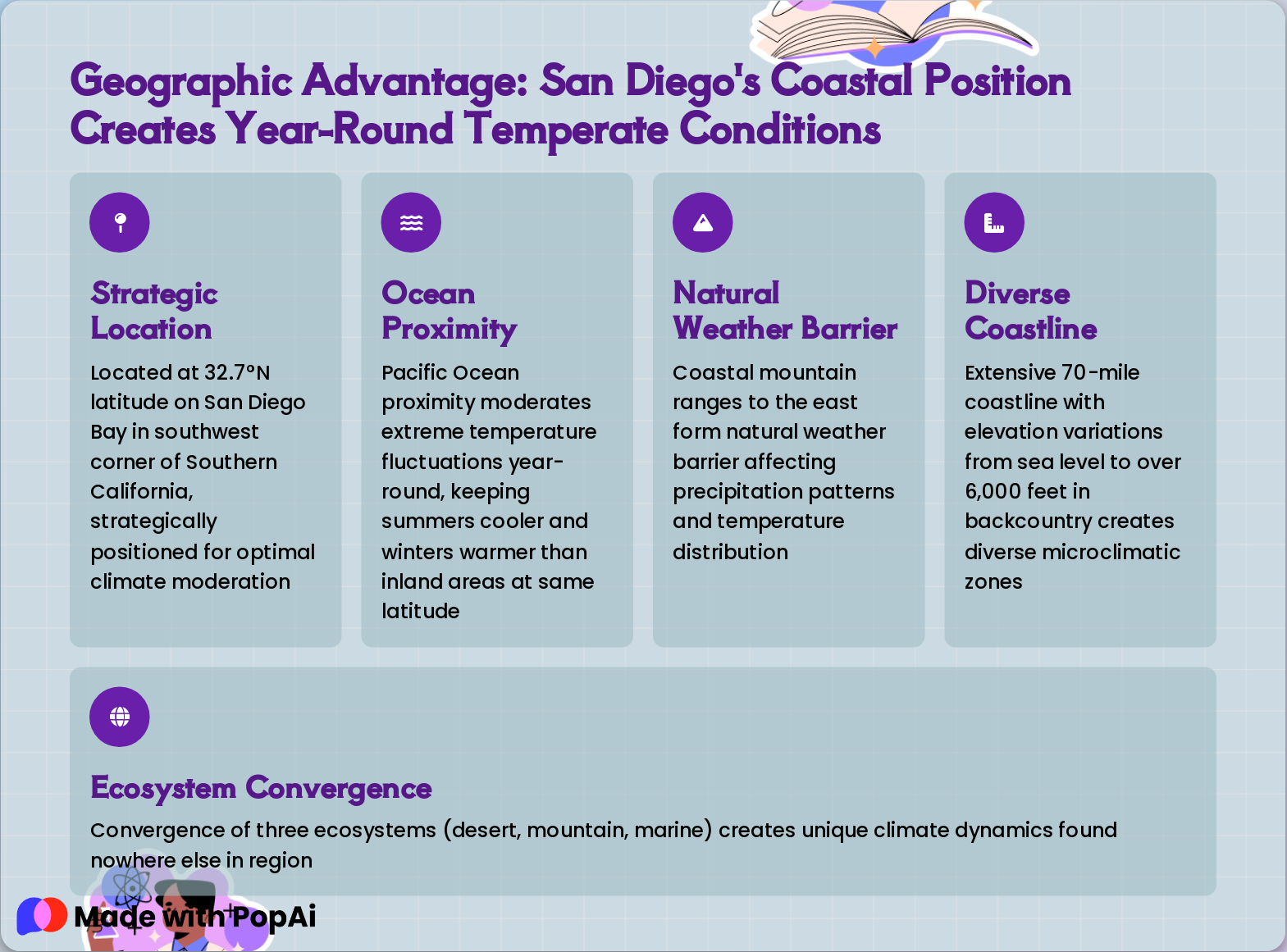
Slide 3: Geographic Advantage: San Diego's Coastal Position Creates Year-Round Temperate Conditions
- Strategic Location: Located at 32.7°N latitude on San Diego Bay in southwest corner of Southern California, strategically positioned for optimal climate moderation
- Ocean Proximity: Pacific Ocean proximity moderates extreme temperature fluctuations year-round, keeping summers cooler and winters warmer than inland areas at same latitude
- Natural Weather Barrier: Coastal mountain ranges to the east form natural weather barrier affecting precipitation patterns and temperature distribution
- Diverse Coastline: Extensive 70-mile coastline with elevation variations from sea level to over 6,000 feet in backcountry creates diverse microclimatic zones
- Ecosystem Convergence: Convergence of three ecosystems (desert, mountain, marine) creates unique climate dynamics found nowhere else in region
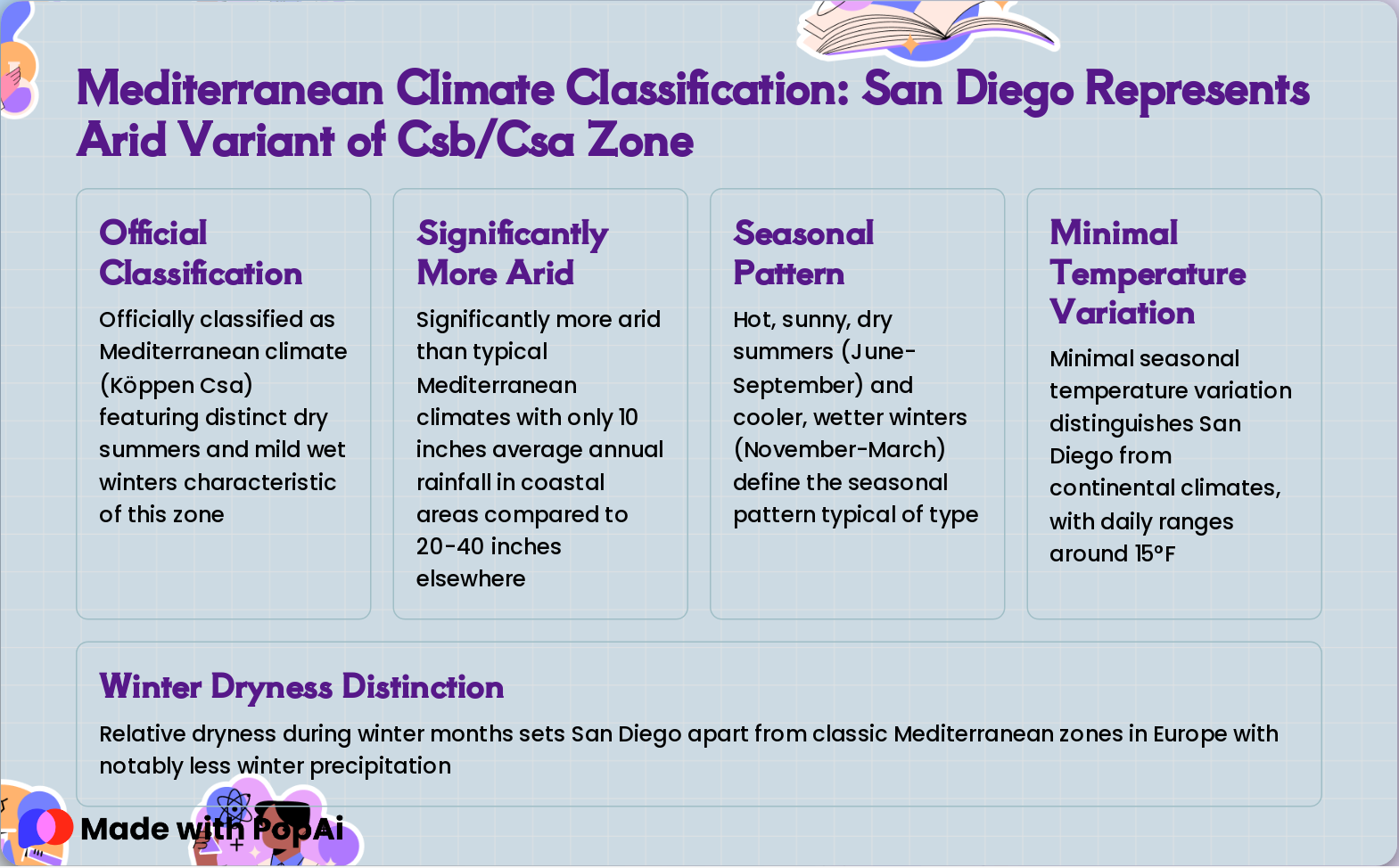
Slide 4: Mediterranean Climate Classification: San Diego Represents Arid Variant of Csb/Csa Zone
- Official Classification: Officially classified as Mediterranean climate (Köppen Csa) featuring distinct dry summers and mild wet winters characteristic of this zone
- Significantly More Arid: Significantly more arid than typical Mediterranean climates with only 10 inches average annual rainfall in coastal areas compared to 20-40 inches elsewhere
- Seasonal Pattern: Hot, sunny, dry summers (June-September) and cooler, wetter winters (November-March) define the seasonal pattern typical of type
- Minimal Temperature Variation: Minimal seasonal temperature variation distinguishes San Diego from continental climates, with daily ranges around 15°F
- Winter Dryness Distinction: Relative dryness during winter months sets San Diego apart from classic Mediterranean zones in Europe with notably less winter precipitation
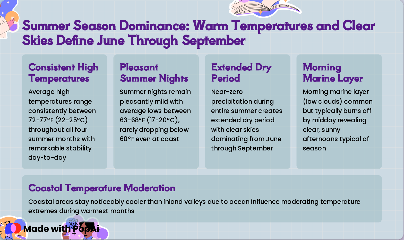
Slide 5: Summer Season Dominance: Warm Temperatures and Clear Skies Define June Through September
- Consistent High Temperatures: Average high temperatures range consistently between 72-77°F (22-25°C) throughout all four summer months with remarkable stability day-to-day
- Pleasant Summer Nights: Summer nights remain pleasantly mild with average lows between 63-68°F (17-20°C), rarely dropping below 60°F even at coast
- Extended Dry Period: Near-zero precipitation during entire summer creates extended dry period with clear skies dominating from June through September
- Morning Marine Layer: Morning marine layer (low clouds) common but typically burns off by midday revealing clear, sunny afternoons typical of season
- Coastal Temperature Moderation: Coastal areas stay noticeably cooler than inland valleys due to ocean influence moderating temperature extremes during warmest months
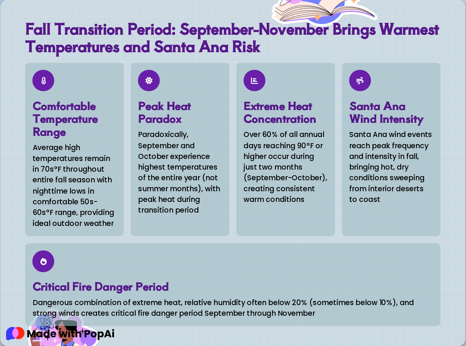
Slide 6: Fall Transition Period: September-November Brings Warmest Temperatures and Santa Ana Risk
- Comfortable Temperature Range: Average high temperatures remain in 70s°F throughout entire fall season with nighttime lows in comfortable 50s-60s°F range, providing ideal outdoor weather
- Peak Heat Paradox: Paradoxically, September and October experience highest temperatures of the entire year (not summer months), with peak heat during transition period
- Extreme Heat Concentration: Over 60% of all annual days reaching 90°F or higher occur during just two months (September-October), creating consistent warm conditions
- Santa Ana Wind Intensity: Santa Ana wind events reach peak frequency and intensity in fall, bringing hot, dry conditions sweeping from interior deserts to coast
- Critical Fire Danger Period: Dangerous combination of extreme heat, relative humidity often below 20% (sometimes below 10%), and strong winds creates critical fire danger period September through November
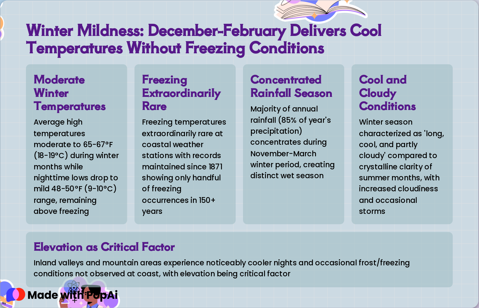
Slide 7: Winter Mildness: December-February Delivers Cool Temperatures Without Freezing Conditions
- Moderate Winter Temperatures: Average high temperatures moderate to 65-67°F (18-19°C) during winter months while nighttime lows drop to mild 48-50°F (9-10°C) range, remaining above freezing
- Freezing Extraordinarily Rare: Freezing temperatures extraordinarily rare at coastal weather stations with records maintained since 1871 showing only handful of freezing occurrences in 150+ years
- Concentrated Rainfall Season: Majority of annual rainfall (85% of year's precipitation) concentrates during November-March winter period, creating distinct wet season
- Cool and Cloudy Conditions: Winter season characterized as 'long, cool, and partly cloudy' compared to crystalline clarity of summer months, with increased cloudiness and occasional storms
- Elevation as Critical Factor: Inland valleys and mountain areas experience noticeably cooler nights and occasional frost/freezing conditions not observed at coast, with elevation being critical factor
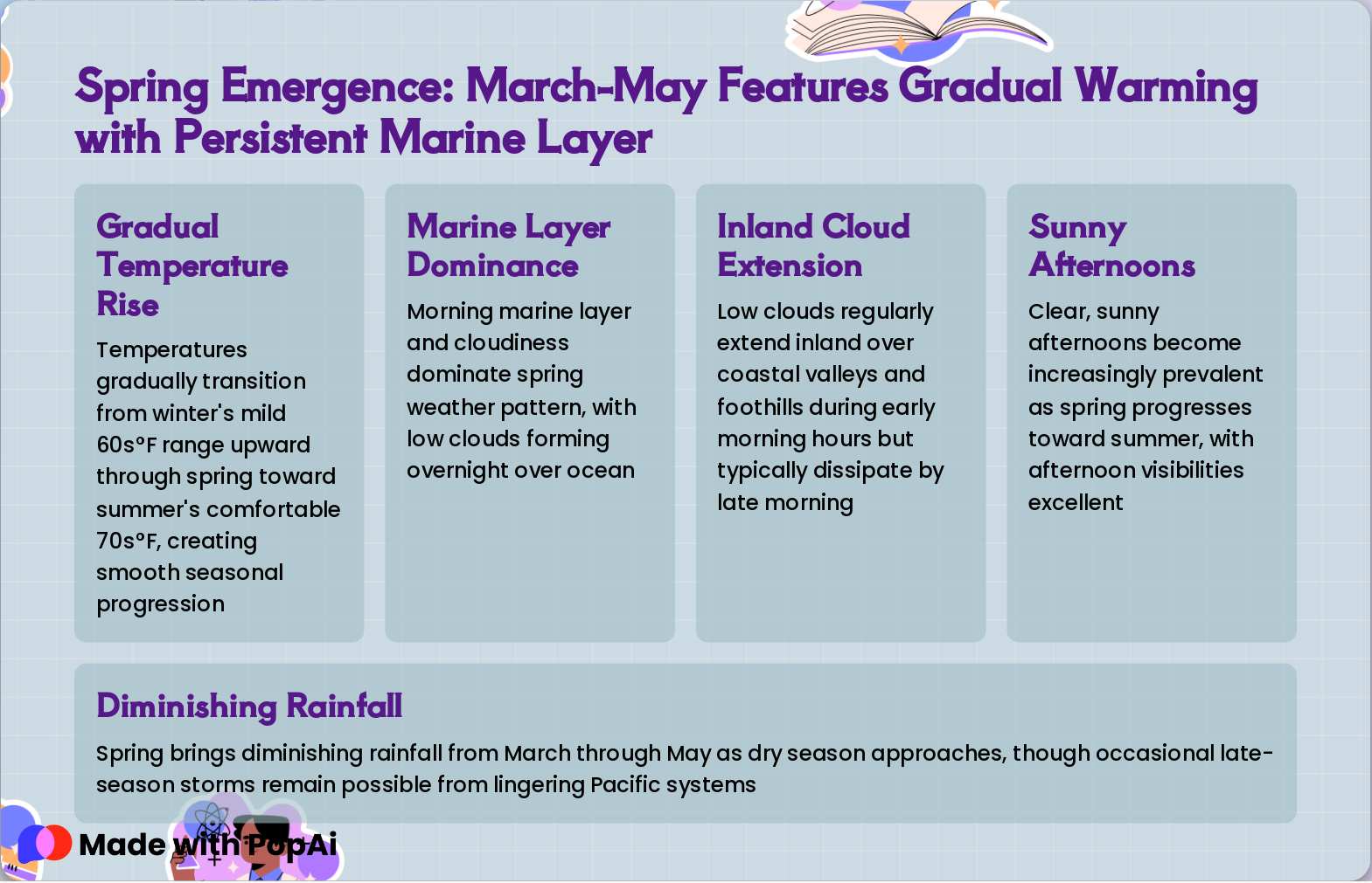
Slide 8: Spring Emergence: March-May Features Gradual Warming with Persistent Marine Layer
- Gradual Temperature Rise: Temperatures gradually transition from winter's mild 60s°F range upward through spring toward summer's comfortable 70s°F, creating smooth seasonal progression
- Marine Layer Dominance: Morning marine layer and cloudiness dominate spring weather pattern, with low clouds forming overnight over ocean
- Inland Cloud Extension: Low clouds regularly extend inland over coastal valleys and foothills during early morning hours but typically dissipate by late morning
- Sunny Afternoons: Clear, sunny afternoons become increasingly prevalent as spring progresses toward summer, with afternoon visibilities excellent
- Diminishing Rainfall: Spring brings diminishing rainfall from March through May as dry season approaches, though occasional late-season storms remain possible from lingering Pacific systems
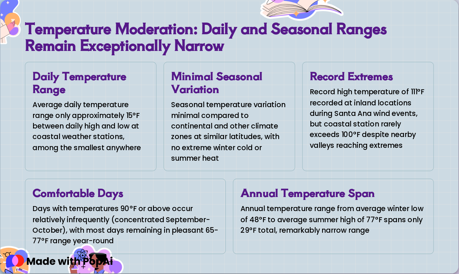
Slide 9: Temperature Moderation: Daily and Seasonal Ranges Remain Exceptionally Narrow
- Daily Temperature Range: Average daily temperature range only approximately 15°F between daily high and low at coastal weather stations, among the smallest anywhere
- Minimal Seasonal Variation: Seasonal temperature variation minimal compared to continental and other climate zones at similar latitudes, with no extreme winter cold or summer heat
- Record Extremes: Record high temperature of 111°F recorded at inland locations during Santa Ana wind events, but coastal station rarely exceeds 100°F despite nearby valleys reaching extremes
- Comfortable Days: Days with temperatures 90°F or above occur relatively infrequently (concentrated September-October), with most days remaining in pleasant 65-77°F range year-round
- Annual Temperature Span: Annual temperature range from average winter low of 48°F to average summer high of 77°F spans only 29°F total, remarkably narrow range
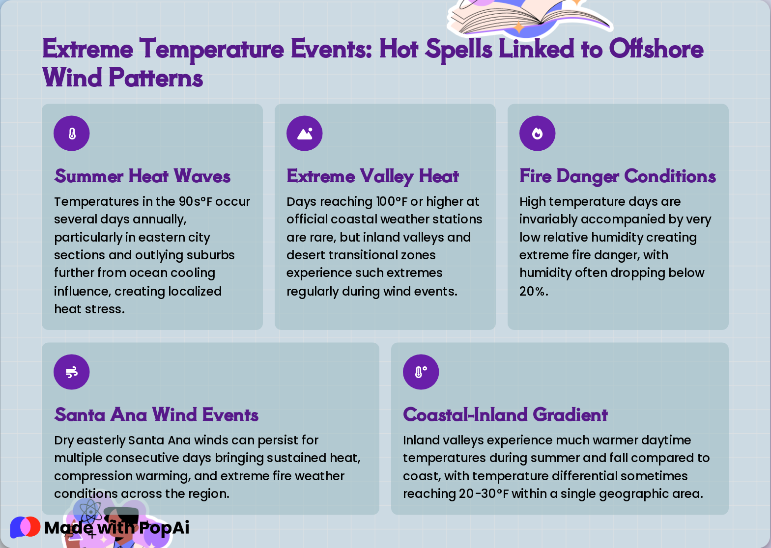
Slide 10: Extreme Temperature Events: Hot Spells Linked to Offshore Wind Patterns
- Summer Heat Waves: Temperatures in the 90s°F occur several days annually, particularly in eastern city sections and outlying suburbs further from ocean cooling influence, creating localized heat stress.
- Extreme Valley Heat: Days reaching 100°F or higher at official coastal weather stations are rare, but inland valleys and desert transitional zones experience such extremes regularly during wind events.
- Fire Danger Conditions: High temperature days are invariably accompanied by very low relative humidity creating extreme fire danger, with humidity often dropping below 20%.
- Santa Ana Wind Events: Dry easterly Santa Ana winds can persist for multiple consecutive days bringing sustained heat, compression warming, and extreme fire weather conditions across the region.
- Coastal-Inland Gradient: Inland valleys experience much warmer daytime temperatures during summer and fall compared to coast, with temperature differential sometimes reaching 20-30°F within a single geographic area.
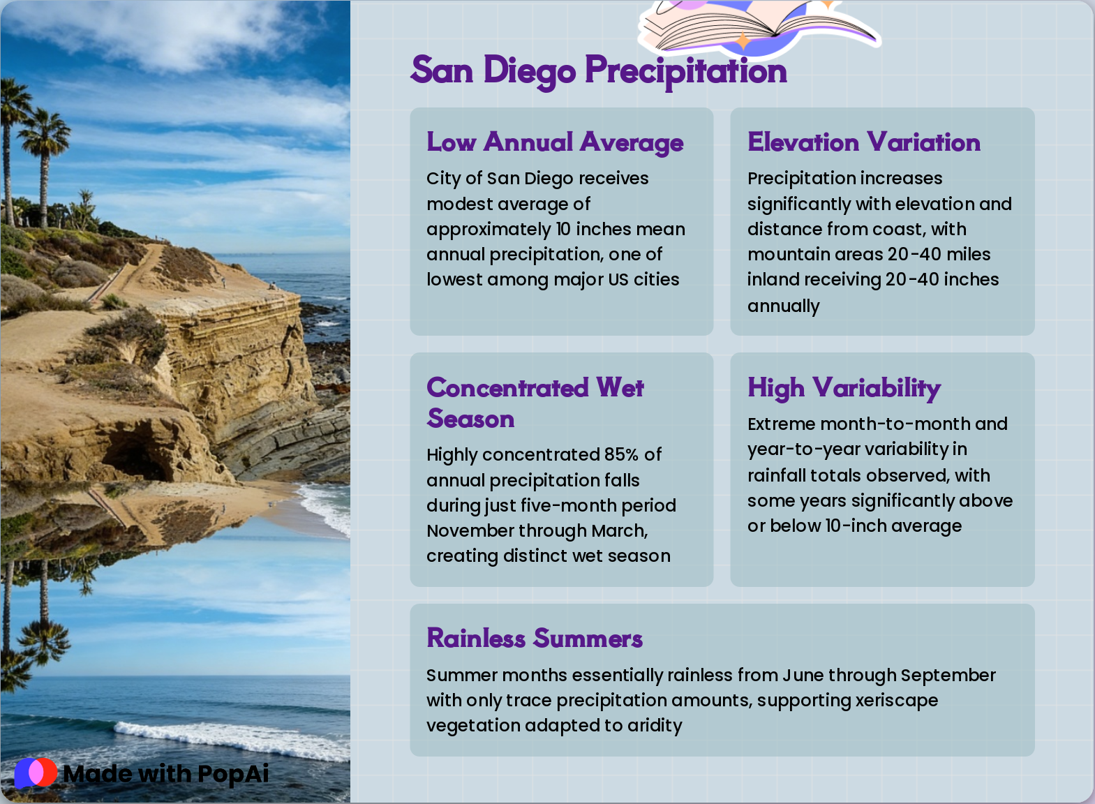
Slide 11: San Diego Precipitation
- Low Annual Average: City of San Diego receives modest average of approximately 10 inches mean annual precipitation, one of lowest among major US cities
- Elevation Variation: Precipitation increases significantly with elevation and distance from coast, with mountain areas 20-40 miles inland receiving 20-40 inches annually
- Concentrated Wet Season: Highly concentrated 85% of annual precipitation falls during just five-month period November through March, creating distinct wet season
- High Variability: Extreme month-to-month and year-to-year variability in rainfall totals observed, with some years significantly above or below 10-inch average
- Rainless Summers: Summer months essentially rainless from June through September with only trace precipitation amounts, supporting xeriscape vegetation adapted to aridity
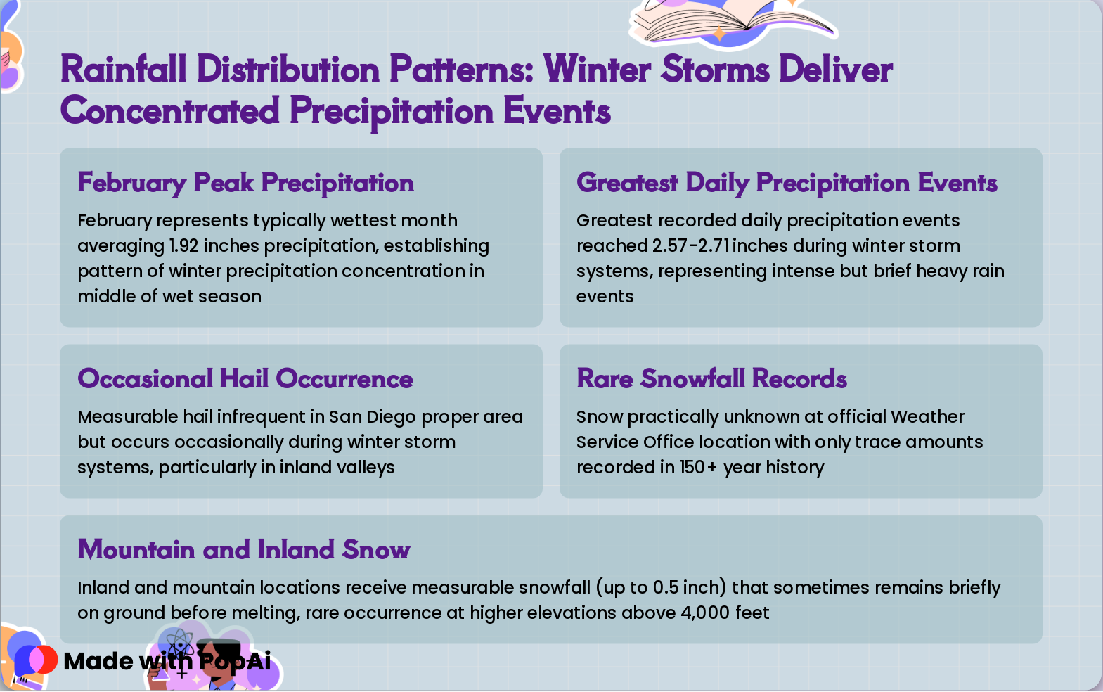
Slide 12: Rainfall Distribution Patterns: Winter Storms Deliver Concentrated Precipitation Events
- February Peak Precipitation: February represents typically wettest month averaging 1.92 inches precipitation, establishing pattern of winter precipitation concentration in middle of wet season
- Greatest Daily Precipitation Events: Greatest recorded daily precipitation events reached 2.57-2.71 inches during winter storm systems, representing intense but brief heavy rain events
- Occasional Hail Occurrence: Measurable hail infrequent in San Diego proper area but occurs occasionally during winter storm systems, particularly in inland valleys
- Rare Snowfall Records: Snow practically unknown at official Weather Service Office location with only trace amounts recorded in 150+ year history
- Mountain and Inland Snow: Inland and mountain locations receive measurable snowfall (up to 0.5 inch) that sometimes remains briefly on ground before melting, rare occurrence at higher elevations above 4,000 feet
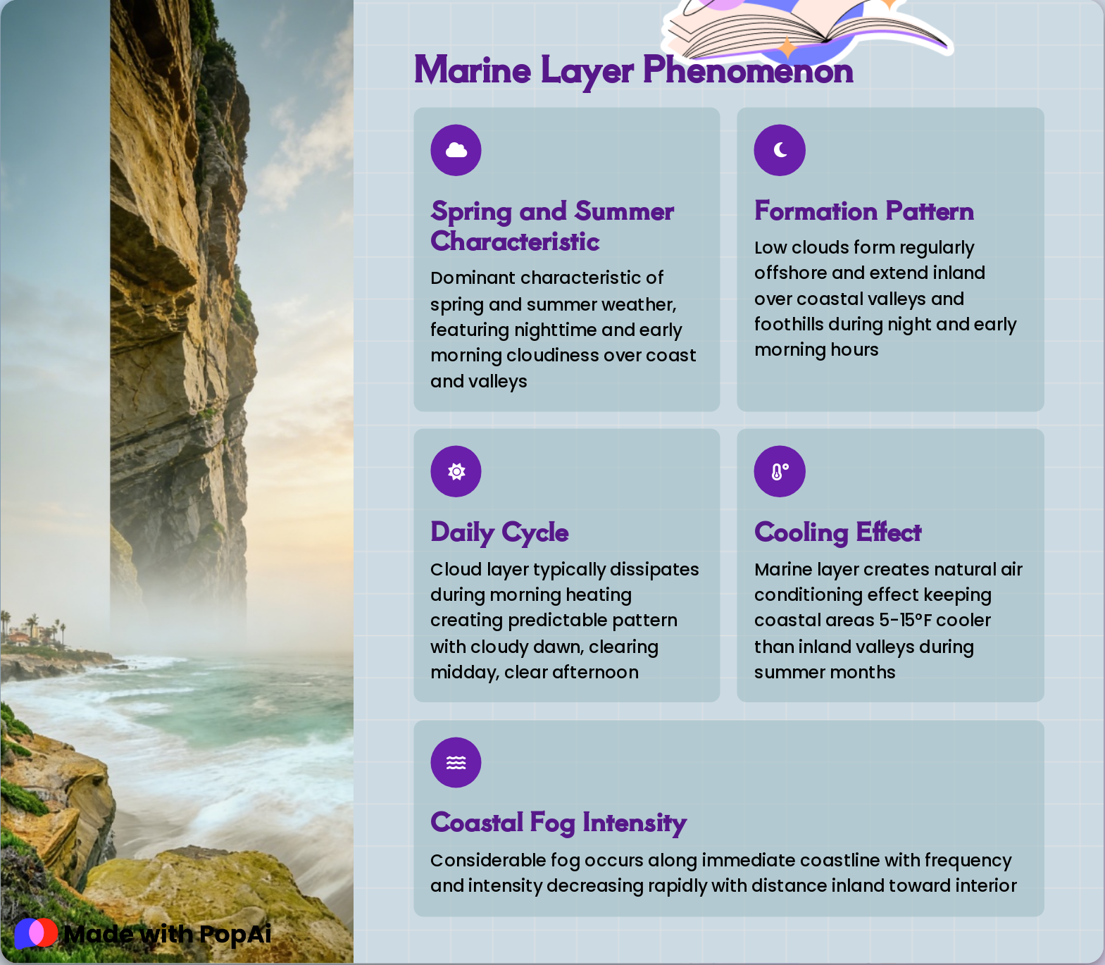
Slide 13: Marine Layer Phenomenon
- Spring and Summer Characteristic: Dominant characteristic of spring and summer weather, featuring nighttime and early morning cloudiness over coast and valleys
- Formation Pattern: Low clouds form regularly offshore and extend inland over coastal valleys and foothills during night and early morning hours
- Daily Cycle: Cloud layer typically dissipates during morning heating creating predictable pattern with cloudy dawn, clearing midday, clear afternoon
- Cooling Effect: Marine layer creates natural air conditioning effect keeping coastal areas 5-15°F cooler than inland valleys during summer months
- Coastal Fog Intensity: Considerable fog occurs along immediate coastline with frequency and intensity decreasing rapidly with distance inland toward interior
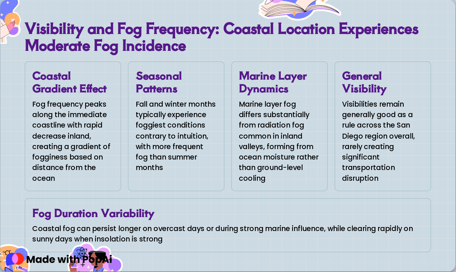
Slide 14: Visibility and Fog Frequency: Coastal Location Experiences Moderate Fog Incidence
- Coastal Gradient Effect: Fog frequency peaks along the immediate coastline with rapid decrease inland, creating a gradient of fogginess based on distance from the ocean
- Seasonal Patterns: Fall and winter months typically experience foggiest conditions contrary to intuition, with more frequent fog than summer months
- Marine Layer Dynamics: Marine layer fog differs substantially from radiation fog common in inland valleys, forming from ocean moisture rather than ground-level cooling
- General Visibility: Visibilities remain generally good as a rule across the San Diego region overall, rarely creating significant transportation disruption
- Fog Duration Variability: Coastal fog can persist longer on overcast days or during strong marine influence, while clearing rapidly on sunny days when insolation is strong
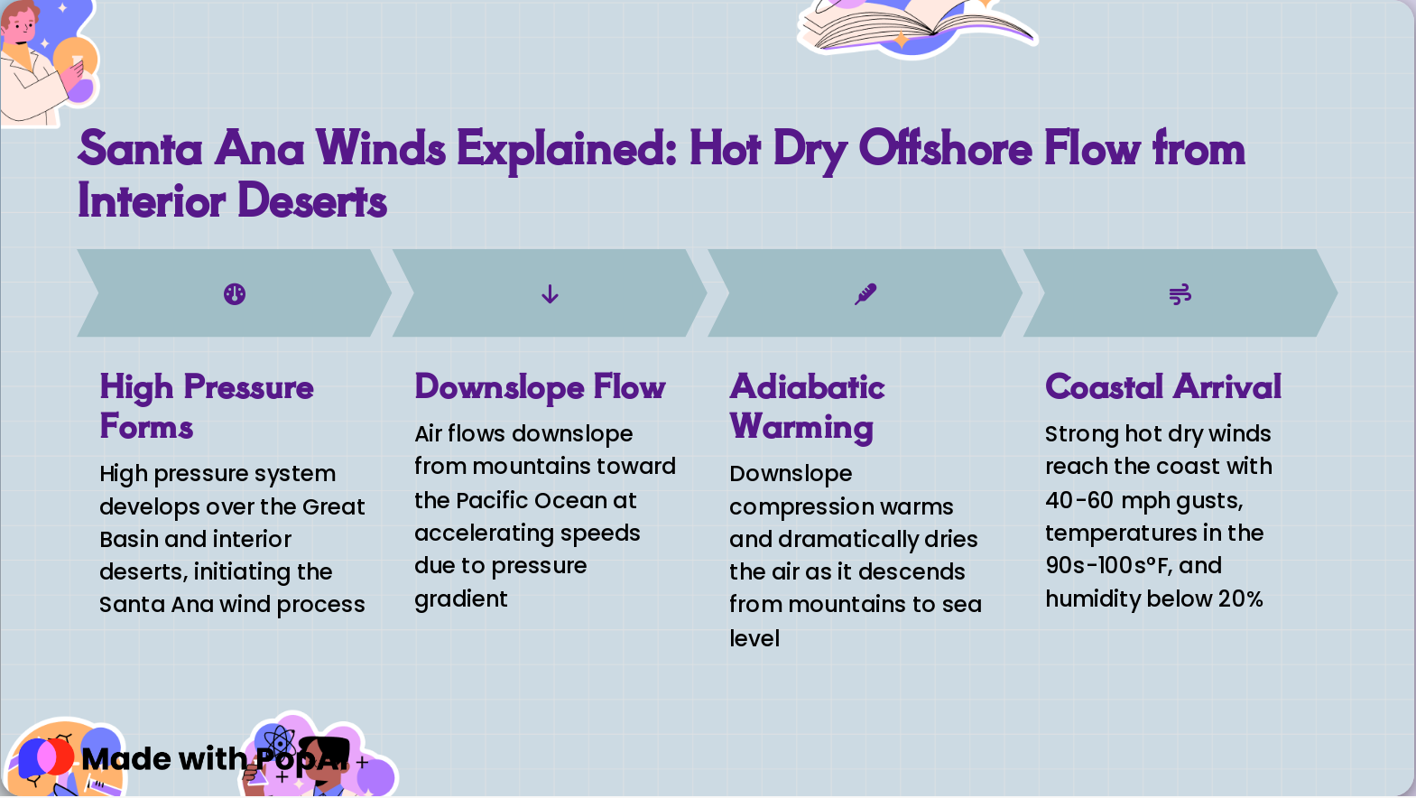
Slide 15: Santa Ana Winds Explained: Hot Dry Offshore Flow from Interior Deserts
- High Pressure Forms: High pressure system develops over the Great Basin and interior deserts, initiating the Santa Ana wind process
- Downslope Flow: Air flows downslope from mountains toward the Pacific Ocean at accelerating speeds due to pressure gradient
- Adiabatic Warming: Downslope compression warms and dramatically dries the air as it descends from mountains to sea level
- Coastal Arrival: Strong hot dry winds reach the coast with 40-60 mph gusts, temperatures in the 90s-100s°F, and humidity below 20%
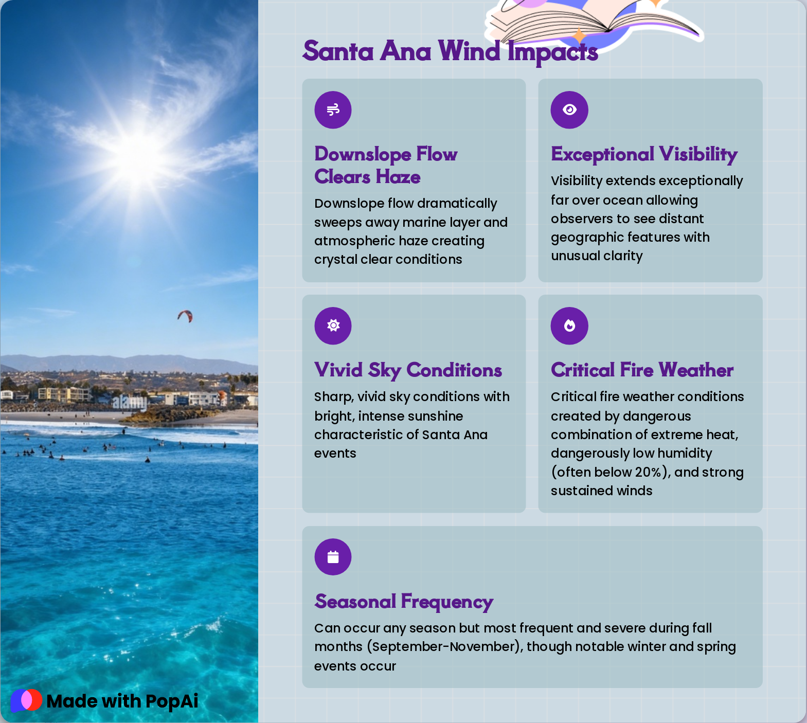
Slide 16: Santa Ana Wind Impacts
- Downslope Flow Clears Haze: Downslope flow dramatically sweeps away marine layer and atmospheric haze creating crystal clear conditions
- Exceptional Visibility: Visibility extends exceptionally far over ocean allowing observers to see distant geographic features with unusual clarity
- Vivid Sky Conditions: Sharp, vivid sky conditions with bright, intense sunshine characteristic of Santa Ana events
- Critical Fire Weather: Critical fire weather conditions created by dangerous combination of extreme heat, dangerously low humidity (often below 20%), and strong sustained winds
- Seasonal Frequency: Can occur any season but most frequent and severe during fall months (September-November), though notable winter and spring events occur
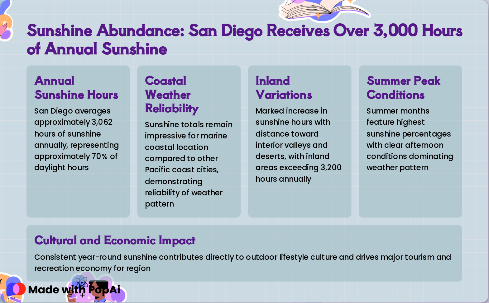
Slide 17: Sunshine Abundance: San Diego Receives Over 3,000 Hours of Annual Sunshine
- Annual Sunshine Hours: San Diego averages approximately 3,062 hours of sunshine annually, representing approximately 70% of daylight hours
- Coastal Weather Reliability: Sunshine totals remain impressive for marine coastal location compared to other Pacific coast cities, demonstrating reliability of weather pattern
- Inland Variations: Marked increase in sunshine hours with distance toward interior valleys and deserts, with inland areas exceeding 3,200 hours annually
- Summer Peak Conditions: Summer months feature highest sunshine percentages with clear afternoon conditions dominating weather pattern
- Cultural and Economic Impact: Consistent year-round sunshine contributes directly to outdoor lifestyle culture and drives major tourism and recreation economy for region
Slide 18: Microclimate Variations: Dramatic Weather Differences Within Short Distances
- Wide Temperature Variation Within Short Distances: The marked feature of San Diego climate is wide temperature variation within short distances of 5-10 miles, with differences reaching 15-20°F across these short spans.
- Distinct Coastal vs. Inland Thermal Zones: Coastal areas remain significantly cooler in summer and warmer in winter than inland valleys, creating distinct thermal zones that define the region's microclimatic character.
- Inland Valley Temperature Extremes: Inland valleys experience daytime temperatures 10-20°F warmer in summer than the coast, while experiencing colder nights and frequent frost in winter.
- Daily Temperature Range Variation: The daily temperature range increases from approximately 15°F at the coast to 30°F or greater just miles inland, reflecting elevation and ocean influence on local weather patterns.
- Primary Microclimatic Factors: Elevation and distance from the ocean represent primary factors creating dozens of distinct microclimatic zones throughout San Diego County.
Slide 19: Regional Climate Zones: From Cool Coast to Hot Interior Desert Transition
- Immediate Coastline Zone: Coolest summer highs in the low 70s°F with mildest winters and no freezing conditions, providing the most temperate climate environment year-round.
- Coastal Valleys: Located 5–10 miles inland experiencing summer highs in the upper 70s to low 80s°F with more pronounced seasonal temperature variation compared to the immediate coast.
- Inland Valleys and Foothills: Summer temperatures ranging from 80s to 90s°F with occasional frost in winter, representing intermediate conditions between coastal and interior desert climates.
- Mountain and Desert Areas: Elevations above 4,000 feet receiving significantly more precipitation of 20–40 inches annually and experiencing greater temperature extremes across seasons.
Slide 20: Historical Climate Records: Extreme Events Rare But Notable When They Occur
- 150+ Year Historical Context: Temperature records maintained continuously at San Diego weather station since 1871 provide 150+ year historical context for understanding extremes
- Freezing Temperatures Extremely Rare: Freezing temperatures documented extremely rarely with only handful of freezing occurrences throughout entire 150+ year record span
- Record High Temperatures: Record high temperatures typically associated with Santa Ana wind events, with 111°F recorded at inland locations but coastal stations rarely exceeding 100°F
- Trace Snowfall at Elevations: Snowfall at coastal elevations recorded only as trace amounts historically in official records, making any measurable snow significant weather event
- Extreme Rainfall Events: Extreme rainfall events occasionally produce 2-3 inches precipitation in single day during intense winter storm systems, though such events remain infrequent and notable
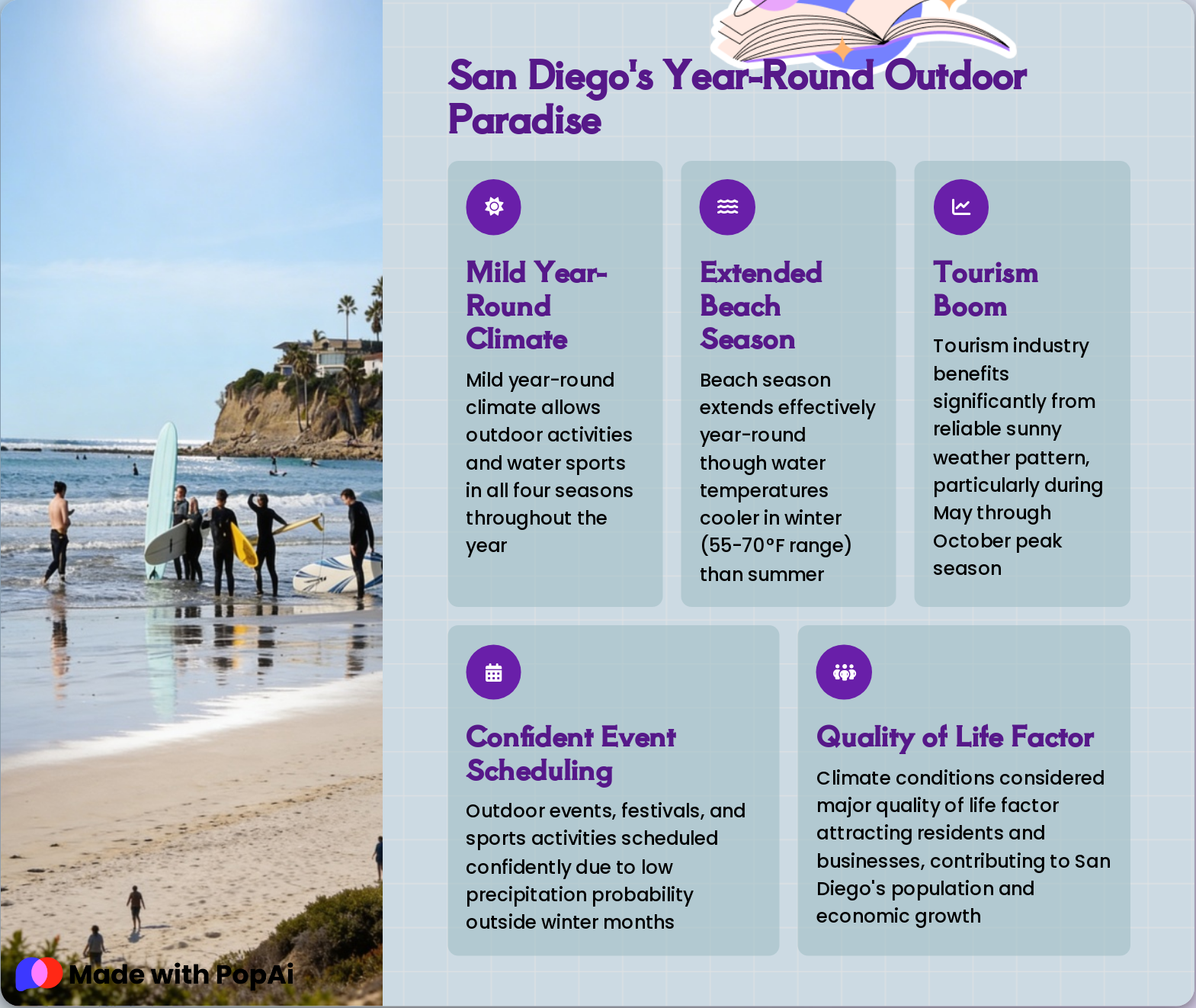
Slide 21: San Diego's Year-Round Outdoor Paradise
- Mild Year-Round Climate: Mild year-round climate allows outdoor activities and water sports in all four seasons throughout the year
- Extended Beach Season: Beach season extends effectively year-round though water temperatures cooler in winter (55-70°F range) than summer
- Tourism Boom: Tourism industry benefits significantly from reliable sunny weather pattern, particularly during May through October peak season
- Confident Event Scheduling: Outdoor events, festivals, and sports activities scheduled confidently due to low precipitation probability outside winter months
- Quality of Life Factor: Climate conditions considered major quality of life factor attracting residents and businesses, contributing to San Diego's population and economic growth
Slide 22: Climate Resilience Considerations: Water Scarcity and Fire Risk Define Future Challenges
- Limited Annual Precipitation: Only 10 inches of rainfall in coastal areas creates persistent water supply challenges, requiring substantial imported water sources to meet demand and maintain ecosystem health
- Climate Change Projections: Climate models suggest increased temperature extremes, longer dry periods, and more frequent heat waves in coming decades, fundamentally altering regional weather patterns
- Fire Danger Escalation: Rising temperatures and persistent dry conditions elevate fire risk, with Santa Ana wind season potentially intensifying in frequency and severity
- Rising Sea Levels: Coastal infrastructure and beaches face mounting threats from sea level rise, despite the region's overall mild Mediterranean climate conditions
- Urban Planning Focus: Resource management and urban planning increasingly prioritize climate adaptation strategies, emphasizing water conservation, heat mitigation, and fire resilience measures
Slide 23: San Diego's Mediterranean Climate: A Unique Balance of Sun, Mildness, and Predictability
Mediterranean climate classification with arid characteristics defines San Diego's weather identity with 10 inches annual rainfall and exceptional sunshine (3,062 hours annually)
Temperature moderation from Pacific Ocean creates narrow daily and seasonal ranges, with winter lows rarely freezing and summer highs typically in 70s, enabling year-round outdoor activities
Understanding San Diego's weather patterns—including marine layer phenomena, Santa Ana winds, and microclimate variations—provides essential context for planning activities and addressing climate resilience challenges
- Mediterranean climate classification with arid characteristics defines San Diego's weather identity with 10 inches annual rainfall and exceptional sunshine (3,062 hours annually)
- Temperature moderation from Pacific Ocean creates narrow daily and seasonal ranges, with winter lows rarely freezing and summer highs typically in 70s, enabling year-round outdoor activities
- Understanding San Diego's weather patterns—including marine layer phenomena, Santa Ana winds, and microclimate variations—provides essential context for planning activities and addressing climate resilience challenges